
You do not have to stagger up the side of the cliffs, huffing and puffing in the skimpy, high-altitude, low-oxygen air to see awesome sights at Capitol Reef. We did, and we loved it, but we just might be a little tetched in the head.
This post will cover a few of the easier hikes and scenic drives.
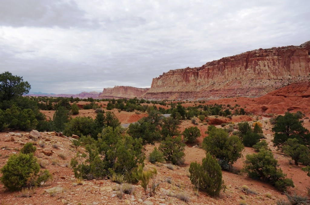
Scenic Drive
Scenic Drive – this is a ten mile paved road that goes past the visitor center, through historic Fruita, past the campground (stop at the Gifford House for pie) and on down the valley. You can then continue another 2.4 miles on a maintained gravel road that takes you part way into the narrow Capitol Gorge. You will get beautiful views of the multi-color layers in the ridges along this drive as well as a good taste of what it would be like to travel through the narrow gorge over a hundred years ago. This WAS the main road back then. There is a parking lot at the end of the gravel road where you can then hike farther into the Gorge. This easy trail has its own blog post. The strenuous Golden Throne Trail also starts from this point but we didn’t do that one.
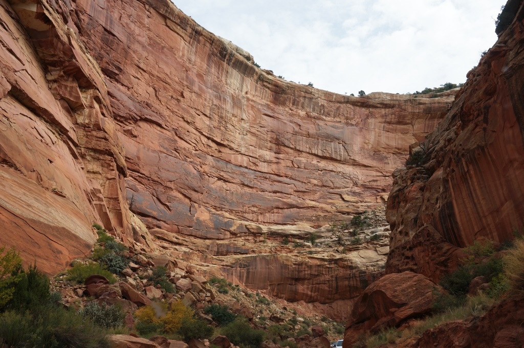
Driving in Capitol Gorge
Burr Trail Road loop – this has its own post but I want to mention here that it can be traveled in a passenger car IF the roads are dry. The Rangers at Capitol Reef or the people at the Torrey Visitor Center can give you road updates.
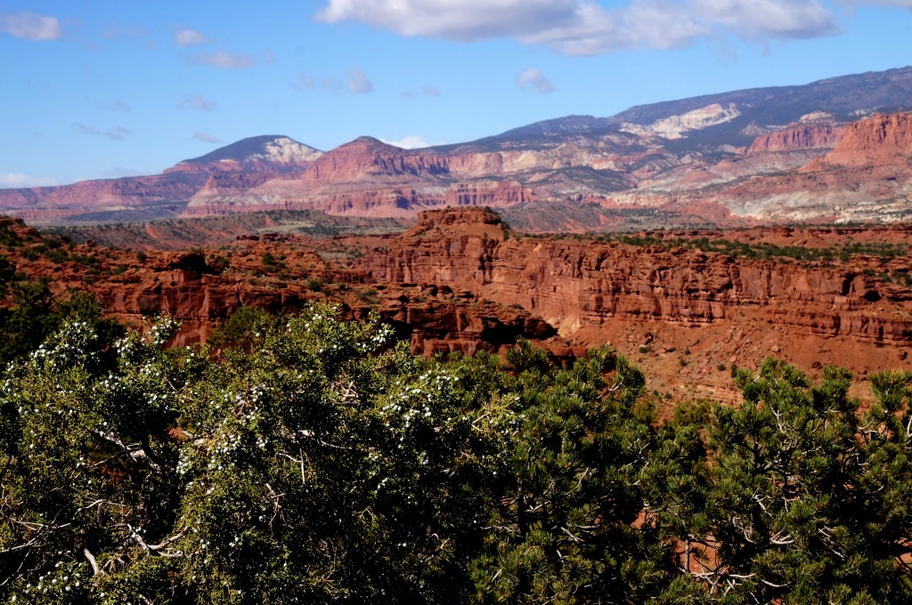
View from Panorama Point
Panorama Point – this is along Hwy 24, three miles west of the visitor center. There is a parking area and a short walk up a knoll where you can get some great views of the Waterpocket Fold. This is also where one of the Rangers recommended we go for the lunar eclipse so it is a good place to view the beautiful dark skies (no joy on the eclipse as the clouds rolled in at sunset – the first night we had in weeks that wasn’t crystal clear).
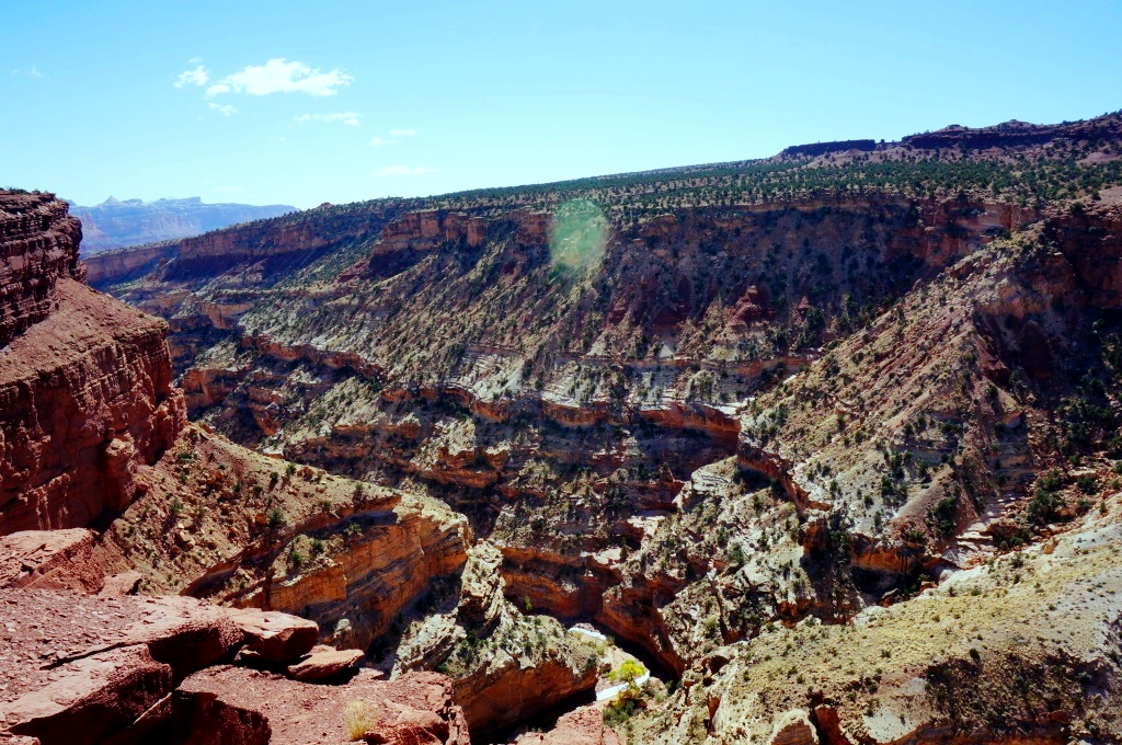
View from Goosenecks Overlook
Goosenecks Overlook – this is a one mile long, maintained gravel road that comes out of the Panorama Point parking lot and ends in another small parking lot. A short trail (.1 mi/one way) goes off to the right from the parking lot to Goosenecks Overlook. It is an easy trail but you do have to go up over a few rocks. At the end of the trail is a viewing deck that sticks out over the beautiful Sulphur Creek Gorge. The viewing area has fencing and rails so you don’t fall off. This is good because the day we were there a storm was rolling in with 40 mph wind gusts and it was ripping through that canyon.

View from Sunset Point
Sunset Point Trail – (.4 mi/one way) goes to the left from the Goosenecks road parking lot. This is a fairly easy trail that goes out on a point and gives excellent views down the canyon. There is a nice bench along the way for those wishing to relax while enjoying the view.
Petroglyphs – there is a parking lot along Hwy 24 with boardwalks and viewing decks for the petroglyphs. There are others in the park but these are super easy to get to and it is a long panel with many rock art drawings. These are covered in another blog post but are listed here as an easy access item. There is a very good daily Ranger program here on the Petroglyphs and the Fremont Culture.
The park also has a nature center but it was closed for the season by the time we were there so we can’t comment on that but there were indications that they run many programs there during the summer season.
So, as you can see, even if you don’t hike, you can still enjoy many of the wonders of Capitol Reef. Happy adventuring!
H
