
October 5, 2020

Blueberry-Filled Slopes and Mount Baker
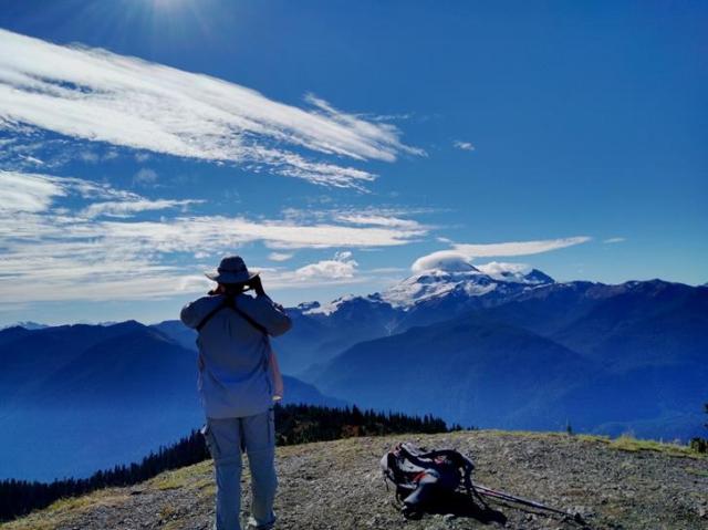
Excelsior Pass can be reached by Excelsior Trail (which has your feet carrying you up the entire elevation between Highway 542 and the pass) or via the Damfino Lakes Trail (where your car carries you up a good bit of the elevation BUT it isn’t a good road). We chose the easy(ish) way and bounced our way up 8 miles of ragged road in the Subaru. We hiked up past Damfino Lakes to Excelsior Pass then headed left on a bit of the High Divide trail to a spur that took us right up to the top of Excelsior Peak. John now has a new favorite view! Even with clouds hanging on the mountains like fluffy white bicycle helmets the views were stunning. Check our pictures and see if you agree.
Those red bushes covering the ground? Blueberries. Yum, yum and yum. John had to keep stopping to find Holly. She was picking blueberries! Sadly none made the trip back to the car. They were picked and consumed in minutes. A few here, a few there…
It was a gorgeous day, we weren’t in a hurry and we eventually made it down the trail with blue-stained fingers. Life is good.

Damfino Lake
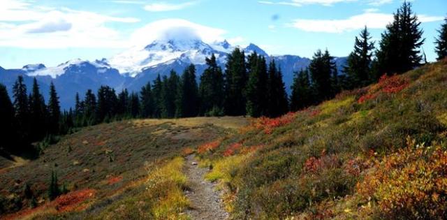
A Trail, Blueberries, and Cloud-Capped Mount Baker

Funguy, the Eighth Dwarf

High Divide Trail

Excelsior Peak with John on Top and Eagles Overhead
One Section of 360-degree View from Excelsior Peak
Side note: The hike book tells a story that long ago a Ranger was asked the name of those little lakes and he replied “Damn if I Know”… Dam-‘f-I-no = Damfino. True story? Who knows? We liked it and decided to share. It sure beats the explanation of the way some other areas we’ve been to were named.
H
