Heading east for the holidays

December 15, 2014

We are preparing to fly back east for the Holidays to see family and friends.. especially our wonderful granddaughter. I can’t wait to make iced Christmas cookies and little chocolate mice (and listen to her response when John teases her – “No, Papa, they are Mice, NOT rats”). We’ll do some crafts, maybe decorate a gingerbread house, visit some holiday light displays, maybe go to Zoo Lights and generally hang out and have quality time. We miss the regular interaction with her and she is growing up so quickly.

Mice! Not Rats!

Mice! Not Rats!

We keep thinking how great it would be for her to adventure with us and learn about all the wonderful things we see but her mommy and daddy seem to be kind of attached to her so they aren’t ready to let her run away with the gypsies. Go figure. We’ll just have to be happy with stealing her during the summer… and maybe spring break. We still have to negotiate that one.

Leaving our camper house takes a little planning and preparation. We’ve already bought plane tickets and arranged storage for the Phoenix, booked a hotel near the Portland airport for the night before and after our travels, rented a car for our wanderings in Maryland and planned a gathering of everybody and anybody for while we are there. We set up doctor appointments and have a list of things we need to dig out of storage and tend to.

As for storage, we hope to get a few things passed on while we are there but the majority will have to wait until we can go back during warmer weather and sell it. We stored far too much stuff thinking we’d be back in a year… and would be moving back into the old house. Neither will be happening. We missed that year thing months ago and the house is just too big. If we go back to Maryland for awhile, it will be to a little condo or apartment near our son and granddaughter so all that stuff we are paying to store isn’t going to fit. (For those of you thinking about going full time, this is an important bit of information. We are paying to store STUFF. And a lot of it is stuff we no longer want or need. I don’t even want to think about how much 16 months of storage fees add up to… or all the cool things we could have done with that money. If we were smart, we would have sold the stuff before we rolled out and had even more play money. Maybe this summer we can get back and sell off or donate most of the stuff. We certainly aren’t going to attempt it in the dead of winter.

But, I digress. Back to the prep for going away… We will spend a day or two at a Portland RV park doing laundry and prepping our coach for the upcoming abandonment. We will go through all the cleaning out and winterizing steps.

This includes cleaning out the fridge and freezer. We’ve been working really hard at eating all the cold food. We haven’t bought food in weeks. What we don’t eat we’ll have to give away or throw away. We were doing pretty good on this food consumption thing until we spent the day out touring and were starving and decided to treat ourselves to Chinese food at Lee’s Wok in Newport. Whoa! They gave us enough food for three meals each. We ate as much as we could and then some, THEN got three big boxes to go. It was really, really good and we don’t want to just ditch it so we will be eating Chinese for breakfast, lunch and dinner for a day or two, then we’ll get back to consuming the other things in the freezer.

Once the cold foods are cleared out, we will pack all our dry goods in mouse deterrent plastic bins, put all freezable stuff like shampoo and liquid laundry soap into plastic bags to contain any potential messes, prop the mattresses to allow better air circulation, etc. We will thoroughly flush out our holding tanks and pour the pink antifreeze through all our plumbing, valves and macerator JUST in case Portland gets a hard freeze while we are gone. I know it doesn’t often freeze in Portland BUT we left our Phoenix Cruiser in southeast Georgia last year expecting to be back before their really cold weather set in. Well, we were in a car accident so we were stuck in Maryland an extra week and a half waiting for repairs which pushed us into Georgia’s colder season AND they had an unusually cold snap hit them earlier than usual (when it rains, it pours). We had debated winterizing before we left that time but did it just in case… well, “just in case” happened and we were truly glad we were “overly cautious”. We plan to be overly cautious again. It doesn’t take us long to blow out the plumbing and dump in the pink stuff but it saves us from a world of potential future problems.

When we first starting listing what we needed to do it seemed like a lot but on reviewing the steps I realized that most of this prep isn’t any different than if we were in a stick and brick house or closing up a summer cottage. It’s just what you do when you leave your home for several weeks.

We are being overly cautious for one more item… The coach will be in a storage area with security but the car will be in a parking lot.  So one extra precaution we are taking is offloading some of the stuff from the car and putting it in the coach just so the car doesn’t look like it is worth breaking into. It isn’t worth it even if we left all our stuff in there, but the crooks wouldn’t know that until AFTER they broke in. So by the time we leave our comfy little house, it will be stacked with bins, bikes, and boxes and will sadly look a lot like that storage unit back in Maryland. At least we will be in that hotel when we get in late and can deal with reorganizing the house and car the following day when we are rested and ready to resume our wandering adventures.

H


Posted in Random Thoughts | 2 Comments

Newport Oregon Area

December 10-15, 2014

We said goodbye to Carl G. Washburn State Park on a cool, rainy Wednesday morning and sloshed up the road toward Newport, Oregon.

Despite the rain, we still managed to catch glimpses of the magnificent coastline and forested hillsides just off the coast. Beautiful, beautiful country.

South Beach State Park

We got to South Beach State Park in a pouring rain. It’s a huge campground and we circled the open loops two or three times searching for a site that wasn’t under water. We found one we liked in Loop B (B-19). I got pretty drenched hooking up our water and electric and was very glad when I could duck inside and take my rain suit off.

We didn’t leave the rig until the next day. As you can see from the following photo, most of the campground drains pretty well but some campsites still had decent size pools. Maybe it’s a good thing we arrived in the rain. We knew our site would remain high and dry.

Our campsite at South Beach SP

Our campsite at South Beach SP

The park has a hospitality center that’s open from 8am to 8pm every day and staffed by the camp hosts. There are a lot of camp hosts – more than a dozen. Like I said in the beginning, this is a huge campground. The staff were very friendly and helpful.

We checked out the hospitality center then wandered a quarter mile down a level, paved trail to the beach. They have a nice overlook tucked into the first dune that is handicap accessible and an access point to cross that dune and stroll along the long, sandy beach.

It drizzled on us during the walk but we made it inside just before the real rain came and the wind started picking up. By sunset the wind was howling and rocking the rig as though it were being shaken by a giant hand. The rain came sideways, beating against the windows. This is where camping in an RV sure beats a tent. Just so you don’t think I’m a total RV snob, I have tent camped in weather worse than this. Keep the wind, replace the rain with snow and drop the temperature about 40 degrees. I prefer the RV.

The next day the sun came out and we had beautiful blue skies. We took a hike along the Cooper Ridge Nature Trail which circles the campground. We then caught the South Jetty Trail toward Newport, returning along the beach until we connected with the interpretive boardwalk trail which took us back to camp.

The Cooper Ridge Trail took us through a really cool natural tunnel. We knew it was okay to keep going because we saw the light at the end of the tunnel. I’m allowed at least one groaner, right?

Natural tunnel

Natural tunnel

The jetty was built more than 130 years ago by the Corps of Engineers. Since then sand pushed north and south along the coast has piled up against the jetties. The shoreline south of the jetty extends out about 1/4 mile farther into the ocean than it did in 1880.

The park has interpretive signs showing how forests now grow on land that used to be underwater. First, pioneer plants like grasses grab hold in the sand behind the dunes. Over time they stabilize and fertilize the soil, allowing taller plants like shrubs to grow. Finally, these shrubs give way to scrub trees which in turn give way to “real” trees and – voila – you have a forest.

Our first peek across the entrance to Yaquina Bay was pretty spectacular. Several California Seal Lions were sunning themselves on the buoy. They barked whenever a fishing boat passed by and I think they were asking for free samples. It didn’t look like they got any. You can see Yaquina Bay Lighthouse on the hill across the bay.

View looking north across Yaquina Bay

View looking north across Yaquina Bay

While admiring the scenery, we watched three Coast Guard training vessels pass along the jetty. We knew they were training vessels because as the sailed along they did nautical wheelies – the pilot would surge forward at full throttle, then suddenly ram the throttle into full reverse, almost pulling the stern under the water.

Coast Guard training vessel

Coast Guard training vessel

The pelican pod (AKA group of pelicans – I looked it up) in the lower right corner were emphatically uninterested in the comings and goings along the jetty. Pretty much not interested in each other either.

The fun for the Coast Guard trainees really got going after they passed the jetty. They sailed south a short distance then started surfing the waves. We watched them for about half an hour. I wondered how many of the trainees lost their lunch. Hope they missed their instructor.

Coast Guard vessel surfing waves

Coast Guard vessel surfing waves

Newport has two lighthouses:

  • Yaquina Bay Lighthouse is located at the entrance to the bay and is part of the Oregon State Park system
  • Yaquina Head Lighthouse is farther north, sits on a promontory jutting 1.6 miles into the ocean, and is managed by BLM. The Coast Guard operates the light.

Yaquina Head Lighthouse

On Saturday, we made it to Yaquina Head Lighthouse, stopping first at the interpretive center. In addition to a gift shop selling T-shirts, sweatshirts, books, and other souvenirs, the interpretive center also has a very nice museum and an excellent short film about the lighthouse.

They have a full-scale replica of the light on top of the lighthouse as well as a model of the lighthouse complex including the light keeper’s house, oil house, and other buildings from back in the day.

Model of lighthouse complex

Model of lighthouse complex

This is the tallest light house on the Oregon coast at 93 feet tall. They offer tours of the lighthouse where you get to climb to the top and gaze out on the world. Unfortunately the lighthouse is still undergoing renovations and it was completely under wraps. Being the (retired) enginerd that I am, I thought it looked like a North Korean water-propelled rocket.

Lighthouse under wraps

Lighthouse under wraps

After all, the surf here is pretty big and could give this “rocket” quite a boost.

View looking south from Yaquina Head

View looking south from Yaquina Head

What’s interesting is that the surf appears to be much rougher to the south than to the north.

View looking north from Yaquina Head

View looking north from Yaquina Head

We walked down to the beach area and saw some harbor seals bobbing in the water just offshore.

Harbor seals bobbing in water

Harbor seals bobbing in water

The Yaquina Head Lighthouse was not a random stop on our trek up the coast. A while back, Holly had been on a government volunteer website and discovered that there were some interpretive host positions available at Yaquina Head in January 2015. I wanted to see what I was getting into before I signed up for anything so we made a point of stopping to check it out. We chatted with one of the interpretive hosts for a few minutes and he really liked what he was doing. We also liked what we saw there so when we got back to the rig, Holly downloaded the application, filled it out, and submitted it before heading east for the holidays. We heard back a few days later that the position had already been filled but the reviewer seemed impressed with our qualifications. I suspect we’ll be camp hosting or interpretive hosting before too long.

For those that are unfamiliar, camp and interpretive hosts volunteer to work at a park part time in exchange for a free campsite. It’s a win-win deal and many retirees spend years doing some type of hosting in parks all over the country.

Yaquina Bay Lighthouse

Yaquina Bay Lighthouse was only in operation for two years – the light itself wasn’t very powerful and Yaquina Head Lighthouse was only four miles away and stuck farther out into the ocean.

Unlike many lighthouses, Yaquina Bay Lighthouse integrated the keeper’s house and the light.

Yaquina Bay Lighthouse

Yaquina Bay Lighthouse

Still, you’d be hard pressed to beat the views. The photo below shows the view from the middle window on the second floor.

View from lighthouse residence

View from lighthouse residence

If you take a walk around the grounds, you get terrific views of the Yaquina Bay Bridge and the jetty.

The Works Progress Administration began construction of the Yaquina Bay Bridge in 1934. When the bridge opened to traffic in 1936, it marked the completion of the Oregon coastal highway.

Yaquina Bay Bridge

Yaquina Bay Bridge

It would be hard to imagine a sweeter place to sit in a chair and watch the world go by.

Jetty

Jetty

 Newport

Restaurant

We ate at Lee’s Wok restaurant which is located right on Hwy 101 (http://leeswokor.com/). We were hesitant to do so since the last three or four times we had Chinese it was not good at all. But we like (good) Chinese food and this restaurant had good reviews on Google Maps so we gave it a go. Are we ever glad we did! The building doesn’t look like much from the outside and the parking lot looks like it is part of the hotel next door, but it is quite nice inside. We had excellent service and excellent food. The portions are HUGE! We each ordered a house special and shared the two platters. Our meals came with a choice of hot and sour or egg blossom soup which were both good. We had Lee’s Wok style sizzling filet mignon and the ginger chicken. Both were excellent! We ate as much as we could then wound up taking three large carry out boxes home. Dinner and tip came to $27.00 (they have a full bar but we stuck with water and the really nice big pot of complimentary hot tea). I’m not sure where you would park an RV near here since it is right on the highway but it is worth giving it a go. We will definitely eat here again if we return to Newport.

J&H

Posted in Campgrounds, Hiking, Parks, Restaurants | Tagged , | Leave a comment

Haceta Head Lighthouse

December 8-10, 2014

Carl G. Washburn Memorial State Park

Out stay was a bit on the soggy side but we really didn’t mind. We seem to be getting used to rainy weather. It seems to rain a little every day, some days more and some days less. We usually see the sun for a little while each day too, even if only for a few minutes.

The temperatures have been moderate – mid-50s to low 60s during the day and low 50s at night.

As with the other Oregon state parks we camped in, this one was also very nice, although the facilities were somewhat older. The showers looked particularly run down, the concrete floors appearing to be 50 years old.

Our campsite was supposed to have full hookups (for $26 a day), but when I went to plug in our electrical cord I saw a sticker saying not to dump our tanks into the sewer because it may overflow. I guess it was OK to hook up your sewer hose if you then opened your dump valves to continuously drain your tanks. But we don’t dump our tanks until they are full or until we are getting ready to leave. We really couldn’t take advantage of the sewer hookup. So we paid the $24 per day water/electric rate. No one made a fuss over it.

Campsite

Campsite

Access to the trail leading to the day use area and beach was right next to our site. We hiked the trail, running across an older gentleman (even older than me) who chatted with us for about an hour.

Haceta Head Lighthouse

It was raining steady and hard when we visited the Haceta Head Lighthouse. We had to bend forward and push ourselves into the wind. We were in full rain suits and waterproof boots. We took our older waterproof digital camera. We were ready.

Haceta Head Lighthouse

Haceta Head Lighthouse

I love these old lighthouses. If I had been a 19th century nerd, I would have marveled at the science and engineering behind this pre-GPS navigational system, which the park did a good job of describing.

The lighthouses along the Oregon coast were sighted as high as possible but below fog level and close enough together so their light envelopes overlapped. The flash could be seen up to 21 miles away. A ship captain, knowing which lighthouses he was looking at, could triangulate to determine his position. Just like a GPS does.

Oregon lighthouses

Oregon lighthouses

The science behind the light is pretty neat too. The beacon was lit by kerosene lamps and turned by a clock-like mechanism.

Fresnel lens

Fresnel lens

Fresnel lens

Fresnel lens

The lighthouse keeper and his two assistant lighthouse keepers lived close to the lighthouse, but not right next to it. The lighthouse keeper’s home is no longer standing. In the photo of the assistant lighthouse keeper’s home you can see Haceta Head Light in the lower left. They had a little board walk going from the homes to the lighthouse that had a railing they could cling to in high wind and fog so they didn’t get lost.

Assistant lightkeeper's house with lighthouse in background

Assistant lightkeeper’s house with lighthouse in background

A lighthouse keeper’s life was anything but easy. The light had to be kept lit and turning 24/7 in any and all weather conditions. That clock like mechanism had to be manually reset every two and a half hours. In addition, they had to grow, raise, hunt or fish for their food.

Still, one of their few perks was the spectacular scenery, even on a storm tossed day like this one.

Looking south from Haceta Head Light

Looking south from Haceta Head Light

 Sea Lion Caves

One of our must-see stops was supposed to be the Sea Lion Caves just a mile south of Haceta Head Lighthouse. But Holly called them first to make sure the sea lions were actually in the cave and was told they weren’t. The storm was kicking up twenty foot swells and the sea lions were out somewhere riding it out. We have to appreciate their honesty and plan to stop in the next time we travel the coast. Their website is www.sealioncaves.com

J

Posted in Campgrounds, Parks | Tagged | Leave a comment

Coos Bay Area

December 5-7, 2014

We spent several days in the area around Coos Bay. The main area of the town is aligned along one side of Hwy 101 with the bay on the other side. We wandered through Mingus Park which is a beautiful park right in town with a lake, landscaped gardens and walking trails. They also have ball fields, playgrounds, a swimming pool, and an arboretum. Some lucky homeowners have houses that face onto the park so they can sit on their decks and see the beautiful plants, flowers, stream, bridges and lake.

Mingus Park, Coos Bay

Mingus Park, Coos Bay

What a great back yard. Not bad for townies. There were lots of empty store fronts when you get back away from the main streets. One park host told us Coos Bay had a much larger population until the lumber mills got all the wood they could out of the area and pulled out.

It is a beautiful area with the large bay and rocky coast. We stayed just south of Coos Bay along Cape Arago Highway. There is a string of three state parks there and we thoroughly enjoyed each one.

Sunset Bay State Park

The park includes a beautiful little cove with a long, shallow, sand beach (which we apparently didn’t take any pictures of). We read it is warmer to swim there (the Pacific is cold up here) and the arms of the cove shelter it from rough surf and ocean winds.

The campground is on the other side of the road and is tucked back in the woods with a little stream running through it. We read reviews before we went and found that Loop D has some nice long sites and a newer, nicer bathhouse so we found a “high and dry” campsite and stayed there.

The ranger and hosts were very helpful and it was a pretty little park.

We walked from the campground to the beach on the bay. This is the rainy season in Oregon and they are having “record” rainfall so we weren’t surprised that the under-the-road tunnel to the beach area was under water. We were not up for wading through cold, knee deep water and decided hoofing it down the road was better.

We wandered down through a beautiful picnic area sheltered in the pines and checked out the flooded volley ball courts on our way by. They were covered with inches of water and John commented that you would drown if you dove for the ball.

We walked a bit of the Pacific Coast Trail that runs all along the coast here and has awesome views of the ocean and shoreline. In fact, you can walk south on this trail for three miles and hit all the parks listed here. We wimped out and drove.

Shore Acres State Park

Next down the road is what used to be part of the estate of lumberman and ship builder, Louis J. Simpson. He had visited this area and fell in love with it. Over time, he purchased all the land along this section of the coast.

According to the signs at the park, he founded the town of North Bend. He gave a piece of waterfront land to any company that came in and supplied at least 50 jobs. Not a bad plan. He brought in the businesses. The businesses brought in the people. And a town was born.

Guess who they elected as Mayor?

The depression took the family’s wealth and the family’s private lands were either donated or sold to the state and turned into the parks written about here.

The three story mansion sitting on a rocky bluff on the ocean was destroyed years ago but the state built an enclosed observation building on the home site that has glass walls on three sides and is an awesome place to watch winter storms.

Great slabs of rock

Great slabs of rock

Looking north from this spot you can see the geology of the area. Great slabs of sandstone jut up out of the ocean where the tectonic plate was pushed up then eroded by the surf.

Going south, the trail passes Simpson Beach, a pretty little sand beach in a sheltered cove with two gurgling streams rolling down into it. You can picture the Simpson children (not Bart and Lisa) spending warm summer days playing on this perfect beach. What a great place to grow up.

Shore Acres Holiday Lights

Shore Acres Holiday Lights

While the views of the coast and coves are awesome, the main jewel at this park are the gardens. The state restored and replanted the formal gardens that were part of the Simpson estate. Not a lot was blooming when we were there but we were lucky enough to hit the park during the Holiday Lights event.

Awesome display

Awesome display

WOW. They have over 300,000 lights strung around the gardens.

We arrived late in the afternoon so we wandered the trails and checked out the beach, observation building and gift shop (good stuff), bought some hot cider and cookies and waited for the sun to go down. The night was warm and soft, the stars were out, and the garden glowed in a rainbow of colors. It was beautiful!

Japanese Garden

Japanese Garden

We especially loved the less formal Japanese garden. I could have settled onto a bench and gazed at the lights and people-watched for hours.

Such cool glasses!!!

Such cool glasses!!!

We bought little cardboard 3D glasses at the gift shop that make the lights look like reindeer, Santa, snowflakes etc. They are really cool and, even though I can’t figure out how they do it, I enjoyed looking through different ones as we wandered the gardens.

I think this shows how much John loves me. I’m wandering around looking through silly little cardboard glasses laughing and saying things like “Cool reindeer,” and he stayed right with me. Not once did he pretend he didn’t know me. That’s got to be love.

Anyway, we bought several pair of these things and plan to gift them to our granddaughter when we hit Maryland. We’ll have to go to a Holiday Lights event with her so we can get goofy and make people wonder what the heck is wrong with these people, wearing weird glasses and laughing about things only we can see.

I can hear it now – “Pssst. Henry, those people see reindeer. I don’t see no reindeer. I think they’re on drugs or something, having them there hallucinations cause there sure ain’t no reindeer here”.

If you visit during the holiday lights event, go early! We arrived to an almost empty lot around 2:00 on a Saturday but it got pretty crowded as the sun set. By the time we left, the parking lot was full, cars were stuck all over at the edge of the trees, and a line stretched out of the park as people waited to pay the $5.00 parking fee to get in. That per car fee is the only cost for this event. Since we have an annual pass for Oregon State Parks, we got in free.

The hot cider and cookies were on a donation basis. The really cool 3D glasses are only $2.00 a pair in the gift shop (you have to get some).

Simpson Reef and Shell Island

Just south of Shore Acres is a parking area with views off the coast. The offshore area is part of Oregon Islands National Wildlife Area and is FULL of critters. We saw California Sea Lions, Stellar Sea Lions, Harbor Seals, Black Oystercatchers, Pelagic Cormorants and more. (No whales yet, still looking.) The sign says Northern Elephant Seals frequent this area but we didn’t see any of those either… at least not the huge males with the big nose flaps.

We first hit this spot at high tide and there were probably a hundred sea lions hauled up onto and draped over the rocks that showed above the water. We noticed one laid out flat trying to stick to the side of a steep rock. It looked like one of those wall crawler/splat toys. When we enlarged the shot we noticed a couple of little guys hanging out on the same rock, one up high and one down low.

Splat Toy Imitation... and a couple little guys

Splat Toy Imitation… and a couple little guys

We swung back to camp for our better binoculars and telephoto lens and headed back at lower tide. Another WOW! There were HUNDREDS of them out there. As more rocks were exposed, more seals and sea lions clambered on.

Shell Island

Shell Island with Simpson Reef in the background

We picked up a brochure at the park and read all the signs at the parking area and learned a bit about the critters.

First, sea lions have ear flaps, seals don’t.

The California Sea Lions are chocolate brown when dry and they bark – a lot. You can hear them over a mile away. The other seals and sea lions pretty much only vocalize during mating season. The California Sea Lions we saw were probably mostly male. They breed down in California during the summer then the males migrate north. Some travel as far north as British Columbia. So the noisy crew we saw was basically a “boys club” barking and posturing and telling tall tales, no doubt.

Stellar Sea Lions (aka Northern Sea Lions) are the largest of the sea lions and are the blondies of the bunch. They are a light sandy brown when dry. They breed in Oregon, just not at this location. They are here to hang out on these great rocks. Male sea lions are 3 to 4 times larger than females. They can get to be over 10′ in length and weigh more than a ton. You do not want to get too close to these bad boys.

The Harbor Seals are easy to pick out. They are light to dark grey and look like inflated toys when they lay on the beaches. They are here year round and breed in this area so in the spring you can come and maybe see seal pups. No little seal babies now but lots of different animals to view and enjoy.

We could see “bands of color” across the beach – The dark California Sea Lions, the blonde Stellar Sea Lions and the grey Harbor Seals. It was pretty neat. We spent a good bit of time watching them swim, climb and maneuver on and around the rocks.

Cape Arago State Park

We moved on down to where the road ends at Cape Arago State Park. They have picnic tables and shelters and views both north and south along the coast. Some of the picnic tables are in little alcoves above the ocean with fantastic views. What a great place to picnic!

We hiked along the path to the north cove where we could see Simpson Reef and Shell Island in the distance. But that’s not the best part. The path ended at a fenced viewing platform with large rocks just below us that were covered in noisy sea lions. (So were you paying attention earlier? If they were noisy, what kind were they? No, I’m not giving the answer – go back and read it again).

The "Boy's Club" at Cape Arago

The “Boy’s Club” at Cape Arago

On our left were rocks where dozens of Black Oystercatchers called out and “danced” with their bright red beaks bobbing to some nature beat that we couldn’t hear.

Doing the Oystercatcher Dance

Doing the Oystercatcher Dance

When we pulled our eyes away from the animal antics right in front of us, we spotted several “rafts” of sea lions floating along in the water. It looked like a dozen or so sea lions somehow holding together, many with one flipper raised in the air. It begged the question – can sea lions hold flippers under water to keep themselves together? Or to simplify the question – How do they DO that?

Raft of Sea Lions at Cape Arago

Raft of Sea Lions at Cape Arago

And since I’m asking critter questions, how do the Harbor Seals bob in place with the waves pushing and crashing against them? They seem able to stay in one spot while they watch you but they don’t seem to “swim” while they do this. Every time I learn something, I find there is more I want to know. Inquiring minds and all that.

Anyhow, this is a great spot for close up critter viewing. It is not too close, but close enough. It is a great spot for kids to observe the sea lions. Bring binoculars if you have them. If you are into beach walking, you can follow a side trail down to the beach and walk along the cove below the cliffs at low tide.

For those non-RVers out there (or RVers with expected company) – Oregon has yurts in their state parks. They run about $44.00 a night, sleep at least five, have electricity, lights and heat and are really nice. You need your own bedding and have to use the comfort stations but it beats a tent in the rainy season or an expensive hotel. You can reserve them online. There have been yurts at every Oregon State Park we’ve hit so far.

H

Posted in Campgrounds, Hiking, History, Nature Notes, Parks | Tagged | Leave a comment

Snickers the Camper House Queen – A Tribute

December 3, 2014

I have the sad duty to report that Snickers, the Camper House Queen, died on Monday December 1, 2014. She was about a month shy of 20 years old. She was dearly loved and we miss her terribly.

September 2012 - Snickers harnessed in park

September 2012 – Snickers harnessed in park

We found Snickers at the animal shelter, all paws, fur and bones. She started talking to us then and never stopped. I fell in love with her in an instant.

We took her home and at bedtime she developed the habit of crawling onto Holly’s chest for her nightly skritches. Holly was a very good skritcher. We think Snickers had been abandoned and had to fend for herself for a while. So she had some intestinal problems when we got her. Holly’s skritches relaxed Snickers so much that there was often a gas leak. The smell was so bad that, on occasion, we had to abandon the bedroom until the smell dissipated.

As a kitten, her favorite toy was a small foam rainbow ball. We’d throw it from the carpeted living room into the vinyl covered dining room. She’d dig her claws into the carpet to gain traction and give chase. When she hit the vinyl floor and tried to stop, she’d slide into and up the sliding glass door. Sometimes the ball would go under a cabinet with a missing kick plate. She’d go spread-eagled, slide under the cabinet, and crawl out with the ball. Dust bunnies and cobwebs clung to her fur. She could do this for hours.

If we threw two rainbow balls she’d begin her chase, then slide to a stop, looking from one ball to the other and not knowing what to do. We could sense that her little kitty brain had shorted out.

Sometimes we’d distract her while she had her hind leg in the air for grooming. She’d pay attention to us for a while then get startled when she spotted her hind leg in the air. Then she’d remember why it was there and continue with her grooming.

For most of her life we had another cat, Chamois. They tolerated each other but that was about it. Chamois claimed the downstairs, especially the living room and sun room. Snickers claimed the upstairs, especially our bedroom. Like clockwork, she’d appear about 9pm every night and announce that it was bedtime. We told friends this and they didn’t really believe us until they happened to be at our house at 9pm.

Back in 2012 when we began planning this road trip, we didn’t think either cat would still be alive by the time we left in August 2013. Chamois died in October 2012. Little did we know that Snickers had other plans. She was the central character during the first 15 months of our life on the road. She wasn’t called the Camper House Queen for nothing.

March 2014 - Aloof Snickers in bed

March 2014 – Aloof Snickers in bed

On travel days, part of our departure prep was to ready the Queen’s travel throne. We placed a ramp for her to climb so she could get onto a low table set between the seats in the cab. A pillow with a special kitty cover would be within reach. Once we’d been on an interstate or other highway for a few minutes, we’d hear her meow and her head would pop above the table. She’d get herself onto the table while Holly grabbed the pillow throne. Snickers could lay there for hours, especially if the sun happened to be shining onto her throne. As soon as the truck downshifted for an exit, Snickers would head back to her safe spot in the corner at the foot of the bed where she “surfed” the corners until we were settled into camp.

April, 2014 - Zen cat

April, 2014 – Zen cat

Our coach has twin beds and Snickers quickly realized that sleeping with Holly meant the constant threat of being rudely ejected from the bed when she tossed and turned at night. So Snickers became my “bed buddy.” She had her nightly bedtime routine – by 9pm like a house mother she’d be nagging us that it was bedtime. On our way to bed she made sure we filled her food bowl with kibble. Once I crawled into bed, there was the obligatory 20 minutes of kitty skritching – reading with one hand, skritching with the other. Holly would pay homage with more skritching or a shoulder rub before getting into her own bed. Then Snickers would move to her spot at the foot of the bed, on top of the pet warming pad we tucked under her blanket, or she would curl up next to my stomach. After the light went out and we settled down, she’d make her nightly rounds – down the kitty steps to nibble some kibble, drink some water out of her fountain, and make one final trip to the litter box. Woe to me if I had to get up in the middle of the night to go to the bathroom. Negotiations were noisy.

May 2014 - Demonstrating proper queenly posture

May 2014 – Demonstrating proper queenly posture

Wake up calls started the moment either Holly or I showed any signs of waking up. Kitty alarms do not have snooze buttons. Holly was usually up first, so she got Snickers her breakfast. After that, it was time for her to roust me out of bed so she could have it all to herself. Just getting out of bed was not enough. The bed had to be made so that the Queen had a smooth, comfy spot to sleep in. In fact, BOTH beds had to be made as one never knew which bed might be blessed with the precious sunbeams.

November 2014 - Snickers on her throne

November 2014 – Snickers on her throne – ears back to let us know she does not like cameras

We often made sandwiches for lunch, especially if we were going out for the day. When we opened the fridge to take out the lunch meat, Snickers’ head would peak around the corner and she’d demand tribute – a piece of deli ham picked apart into kitty-sized bites and maybe some bits of provolone or cheddar.

On days when Holly and I went out hiking or sightseeing, we usually got back late in the day – often after 4:30pm, Snickers’ standard feeding time. Before opening the door one of us would ask, “Who wants to go first?” knowing that the first one through the door would get an earful of Snickers-speak.

We kept human snacks and kitty treats in the cabinet directly across from her spot on my – I mean HER – bed. Whenever Holly or I opened that cabinet and reached for a snack, Snickers would wake up and demand her treat. It was only fair. We were snacking, so should she.

We don’t always realize how much a part of our lives someone is, people or pets, until they are gone. Snickers was definitely that someone. We may have been her minions, but we were happy minions.

Until we meet again dear Snickers,
May the catnip never run out,
The water fountains never stop flowing,
The clouds never block the sunbeams,
The treats never run out,
And the rainbow balls never stop rolling.

J


Posted in Trials and Tribulations | 4 Comments

Harris Beach State Park – Oregon

November 21 – December 5, 2014

Although we stayed here for two full weeks, we didn’t do as much sightseeing as usual.

We may travel around the country, going where we want, staying where we want for as long as we want, but that doesn’t mean bad can’t find us. It found us at Harris Beach and stuck.

While life on the road has many benefits and advantages, there are some disadvantages, especially when people and pets get sick and stuff breaks. Our local doctors, dentists, vets, and mechanics aren’t local anymore. When stuff happens, we have to try and find someone to help without knowing if they’re good, reliable and honest. Sometimes we’re in a remote location where help of any kind isn’t available.

I had had some chest congestion for about 6 weeks – coughing and hacking for an hour or so in the morning and off and on all day. It didn’t really stop us from enjoying ourselves, but it did affect how long we could be out and about before I wore out. We were traveling through some pretty remote places so I just dealt with it.

A few days after we got to Harris Beach, I went to the urgent care clinic, Curry Medical, in Brookings, OR. They checked me out and prescribed some medication. It took a while but it seems to have worked. I’m not hacking like a 2-pack a day Camel cigarette smoker anymore… but now Holly is coughing and wears out easily. At least we take turns.

We made Thanksgiving dinner in the rig – turkey breast, sweet potatoes, packaged stuffing, cranberry relish, frozen veggies, Grands biscuits, and mini-pies. Not exactly gourmet but still good. Instead of eating with our plates on our laps like we usually do, we put up the table. No fine china, silverware or crystal but a very nice dinner.

It would have been a better Thanksgiving if Snickers hadn’t gotten sick. She started vomiting Thursday afternoon. She stopped eating and drinking. She stopped talking to us. In short, she stopped being Snickers.

She didn’t improve on Friday or Saturday and when we stopped being able to get enough water into her, we took her to the Town and Country Animal Clinic in Brookings on Sunday morning.

We thought this was probably another case of acute pancreatitis, which she’d had twice before, the last time in July. This time the treatment was essentially the same – subcutaneous fluids, an injection of pain meds, and an anti-nausea med. They added another medicine to stimulate her appetite. When they brought her out to us, she was extremely violent. When Holly went to try and calm her down, Snickers bit her hard enough to draw blood. This was not the Snickers we knew. Every other time we had taken her to a vet, when they were done with her and she was back with us and in her cat carrier, she was – if not calm – at least quiet. The vet said the appetite stimulant might make her a little anxious. A little?

We took her home, expecting her to slowly return to her old self, but she didn’t. She remained a devil cat for the next 8 or 10 hours. We called the vet after a few hours to ask if this was a problem. She said it wasn’t unexpected so we isolated Snickers on her bed. Holly hung a blanket as a curtain so Snickers wouldn’t be able to see us. She growled and hissed whenever we disturbed her.

Around 10pm she had exhausted herself and let us get close. She was alert but her breathing was rapid and shallow. We tried to get her to drink some water but she refused. Every few minutes she’d cry as though she were scared, asking us to fix whatever was wrong. But we couldn’t. She let me skritch her and she seemed to calm down. But when I stopped, she’d cry again. So I skritched her until I thought she was asleep. I eventually made it to bed. I slept on the couch so I didn’t disturb her.

About 5:30am, Holly woke me and said she thought Snickers was dying. We put a towel on Holly’s lap and laid Snickers on it. We both stroked and nuzzled her. Snickers’ breathing was again rapid and shallow, with a deep breath every minute or so. She was unconscious, maybe in a coma. I got a flashlight and checked her pupils. One appeared to be “blown” and I suspected she may have had a stroke, although I wasn’t sure when.

We continued stroking her until, about 6:30am, she took her last breath and died.

We took her remains back to the vet and talked to her about the treatment. We found out the medicine that would make her anxious was oral and would not have kicked in for hours. Yet she was going nuts right after they treated her in the back room. They had led us to believe it was the drug but it couldn’t have been. Holly and I both know something went terribly wrong at the vet but don’t know what. It haunts us, especially Holly, that Snickers should still be alive.

But we were blessed with her for almost 20 years. She was a wonderful, colorful, talkative, and slightly ditzy cat. We loved her and miss her. I keep some of her stuffed animals at the foot of my bed to remind me of her. Just call me a sentimental, crazy old coot.

Unfortunately, the bite Snickers inflicted on Holly got infected and her whole finger swelled up. (We were told that the probability of a cat bite getting infected was 100% and that there was a high risk of the infection spreading through her body.) So we went back to the urgent care clinic where Holly was prescribed an antibiotic. We didn’t want to leave the area until we were sure the bite was healing and the infection on its way to being gone so we stayed until our two week limit was up and we had to leave. It’s good we stayed. Holly had to return to have the wound cut and drained. Soon after that the swelling went down and the wound began to heal. She was still coughing though. That would stay for awhile.

Before Snickers’ got really bad, we took a drive up the coast and checked out several beautiful parks along the way. We went all the way to Gold Beach and stopped at a really good visitor center there. The lady working there was awesome and when she found out we were considering moving to Oregon, she started telling us all the great things in the area which include a lot of organic farms. When she heard we had a Subaru, she suggested we swing up the road along the Rogue River and hike in an old growth forest there. What she didn’t tell us is that it is a windy, narrow, bumpy Forest Service road up the side of the mountain to reach the trail – but what looks like a one lane road is two-way. We only met two vehicles on the road and managed to pass both without issues, mostly because we were driving really slowly. It is a nice trail with a brochure in a box at the trailhead. The trees, live and dead are draped in moss and ferns. We found it interesting that here, miles off the main road and another half mile into the forest, they have placed a picnic table. It is just tucked away along a babbling stream under the big trees. It’s a beautiful spot but that’s a long way to go for a picnic.

After our little round about tour, and as we headed back to camp, we noticed an odd noise from one of the rear tires. We had known for a while that there was something wrong with our toad (tow vehicle), the Subaru Forester. The back tires were wearing very unevenly. The Subaru dealer that did our oil change in Utah thought we were good until at least the next scheduled service. He was wrong. We pulled over to the side of the road and checked the tire making noise. One spot had worn through to the steel belt. So between our clinic visits, we took the car to Les Schwab, a local tire chain, again in Brookings. Being an all-wheel drive vehicle, they wouldn’t replace just the rear tires with a different brand. The manager said he could order identical tires to those on the front and have them delivered the next day. Good deal, I thought. Then he disappeared and reappeared a few minutes later. He said he had a pair of used tires identical to those on the front and with about the same amount of tread left on them. Sold!

So instead of spending $800 plus for four new tires or $400 plus for two new tires, I got away with $200 for two used tires. I may be cynical, but I keep thinking about how much more this would have cost me back in the DC area.

So our two weeks at Harris Beach were not the best we’ve had so far. Like any “lifestyle choice”, there are positives and negatives. Even with this rash of bad stuff, the positives far outweigh the negatives.

And, despite all the bad news and problems we had while we were there, we loved the park and the campground.

We snagged an ocean-view campsite with water, electric and cable (but no sewer) for $25 a night. Surprisingly the primo sites are all walk ins. If you reserved a site online and a walk in site is available when you arrive, you can switch sites. You just have to notate the reservation envelope and adjust the money when you pay. This is what we did.

We took lots of walks on the bluffs above the beach, scrambled on the rocks down to the beach, and strolled along the sandy beach as well. There are a few little streams that flow out along this beach. We loved watching them carve canyons and arches in the sand at low tide. One tended to split and wind like the Mississippi River. Just one hard chunk of sand or rock could divert the stream and send it on a different course. It was the erosion and sculpting of the earth on fast forward and in miniature.

Ocean view

Ocean view

I loved perching on a rock overlooking the ocean and watching the surf crash into the jagged rocks poking out of the water or surging through a rock arch. We found a few tide pools and spotted sea anemones and hermit crabs. We found lots of long thick rubbery filaments of kelp washed up onto the shore, their bulbous “heads” topped with kelp leaves. We’ve spent a lot of time gazing out to sea but still haven’t spotted whales. We saw a few seals and dolphins cruising along in the surf and lots of sea birds.

While hiking in the trees we came across this Texas-sized slug.

Slug

Slug

Not as big as we’ve seen but big enough. I can put the “it’s cloudy and rainy for six months along the Northwest coast” refrain to rest. While we were here, we had a jaw-dropping, absolutely gorgeous sunset one evening.

Harris Beach sunset

Harris Beach sunset

Even when the sun disappeared below the horizon, it painted the clouds in gold.

Harris Beach sunset

Harris Beach sunset

So bad things do happen, but all in all, life is good.

J

Posted in Campgrounds, Parks, Random Thoughts | Tagged | Leave a comment

We Made it to Oregon!!!

November 21, 2014

Our goal is to winter in Oregon to see if we want to live here year round. We have done an extremely slow wander to get here but we finally made it. We will spend at least three or four months in western Oregon and Washington just getting a feel for the weather and the communities. We may wander east of the Cascades but we aren’t into high desert so the majority of our time will be west of the mountains.

At some point we will buy or build what we expect to be our last house. We fell in love with Oregon years ago and haven’t found anywhere else that beats it. Now it is time to find out if it is truly what we are looking for… and if we are tough enough to handle the cold, drizzly Pacific Northwest winters. At some point we will be too old to just jump into the Phoenix and run away to better weather so our retirement house needs to be somewhere we want to be year round.

Yes, we’re late getting here. We’ve been told that the winter here usually starts in late October. But, guess what? They had an unusually long Fall/Indian Summer and winter just kicked into gear here so we can claim to be right on time. Sort of.

We are having to rejigger a few things in the house. The day we rolled into Oregon it was windy and pouring with massive puddles on the camp road. We wore our full rain suits but once set up and back inside we had to deal with two sets of: wet boots, wet rain pants, wet rain jackets, wet hats and damp pants and socks. The floor was a muddy mess and we were chilled. Hmmmm. We hung wet stuff EVERYWHERE, turned on the heat and made a shopping list while we warmed up and dried out.

Next day we went off to the store to buy a “Tripod Air Dryer” that fits in our shower (or living room, or between the beds, or in the main bath area). The shower is best for catching drips so it will usually be in there when needed. It is two poles that lock together. There are three legs on the bottom piece and three arms on the top. It can hold 18 hangers of wet stuff. The two ends open and close like an umbrella so it will be easier to pack away during drier days (yes, it is one more thing to store). They also make it with two tiers.

Next was the poor floor. We found a nice floor mat with rubber backing and top frame and industrial carpet type top that says it holds a full quart of water. So far, so good. We’ve been meaning to upgrade the mat we keep on the ground under the steps since our old one is mostly dead. This drenching has motivated us to work a little harder at getting that done. We plan to buy a piece of the rubber backed indoor-outdoor carpet from Home Depot that we already have in our step well. It is light weight, flexible and fairly easy to clean. They have it on a roll and sell it by the foot. It doesn’t have a raised border so water will run off it which is best for outdoor use.

Our next purchase was a small dehumidifier. We went from nose-bleed dry desert to damp air that is condensing on the inside of our windows. I’ve read where people have had trouble with condensation between the mattresses and the walls. We definitely want to avoid that so we ordered YET ANOTHER boxy thing to store on board.

Clothing wise we should be good. We have quick dry clothes, fleece and wool that keep you warm even when wet, waterproof boots, and those much needed full rain suits. I’ll add a couple pairs of gaiters for hiking in wet woodlands or snow and we should be set.

OK, Oregon, bring it on! We can do this… and enjoy it.

H

Posted in Random Thoughts | Tagged | 1 Comment

Redwood National and State Parks

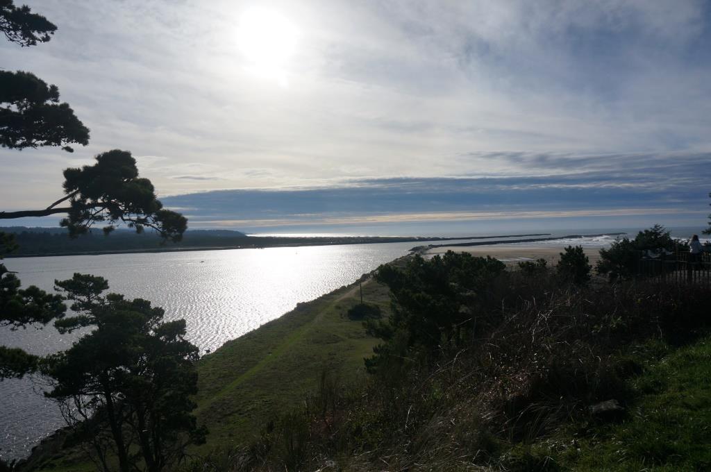
November 18-21, 2014

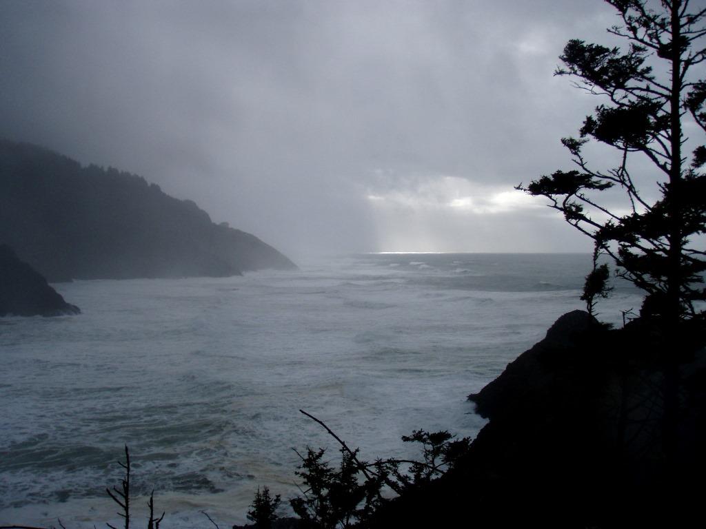
For the past two months we traveled through areas that had few clouds, lots of sun and almost no rain. As we headed north up the coast, that was about to change. More clouds, less sun and a lot more rain were in our future. Now we’ll start to experience winter in the Northwest, which is why we’re here. If we can handle it, we may settle here. If not, we’ll look elsewhere. We’re both hoping we can handle it as we both love the Northwest, west of the Cascade Mountains.

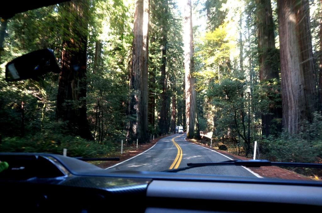
Our last stop in California was Redwood National and State Parks. In an unusual Federal-state partnership, Redwood National Park encompasses three California state parks, Del Norte Coast Redwoods, Jedediah Smith Redwoods, and Prairie Creek Redwoods State Parks. We spent time in Prairie Creek and parts of the National Park property.

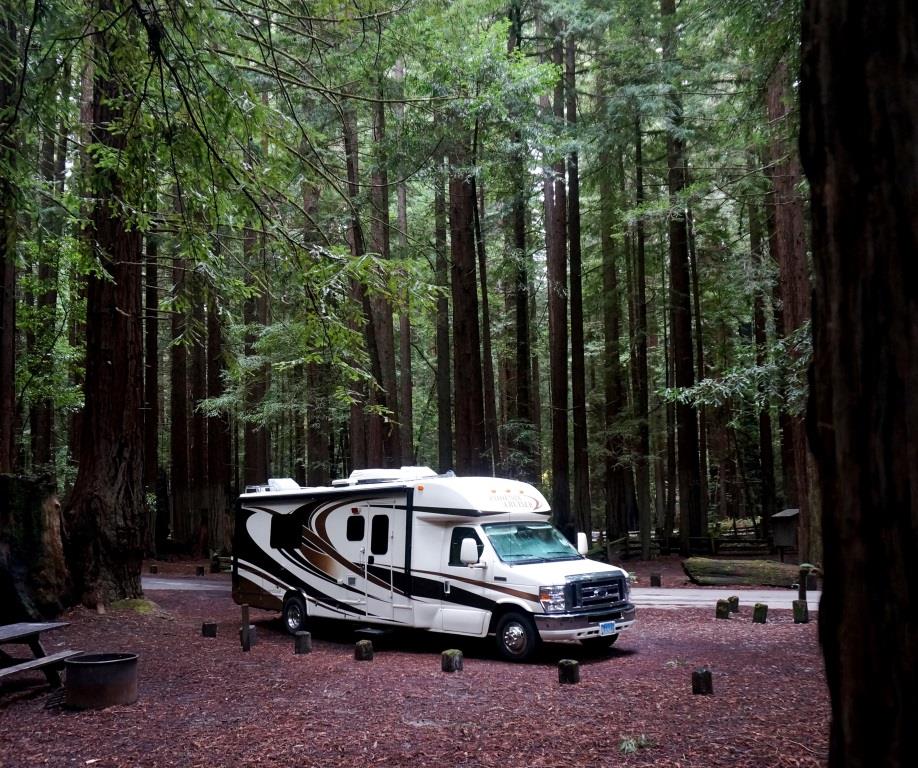
Although we enjoyed our stay here, we liked Humboldt Redwoods State Park better. That was partly due to our camping right in the middle of the redwood forest and better weather. We had a couple of nippy nights at Humboltd Redwoods so we went to a private campground to get hookups while we toured this area. This meant packing up our gear and driving to the parks.

Visitor Centers

Kuchel Visitor Center

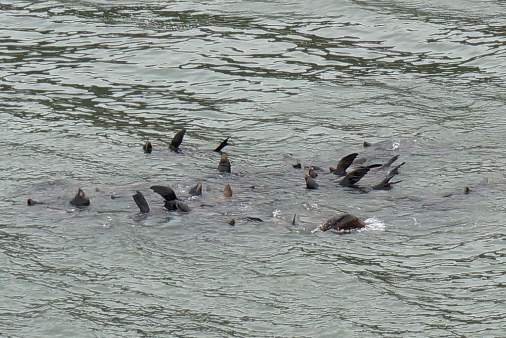
As we rolled up Hwy 101, we passed a big sign saying “You are now in elk country”… and just past the sign, there they were, hanging out on both sides of the road. Then they were in the road. It always intrigues me how one animal seems to step out into the road to stop traffic. That animal stays until the others have crossed then follows them off the road and traffic can resume as normal. We’ve had bison, cows, and now elk do this. The “crossing guard” usually stands in the road and stares down the cars just like human school guards do. It seems weird to see the animals do it. We were quite happy to idle in the road and watch these magnificent animals cross over… which is good, because they took their time.

Elk herd off Highway 101

Elk herd off Highway 101

Shortly after our elk encounter we reached the Kuchel Visitor Center. We had to quickly pull up Google maps/satellite view to make sure we could turn around since we were in the rig with car in tow and you can’t see anything from the highway. They have a large looping parking lot so no worries. We pulled into the empty lot leaving enough space in front of us to angle out toward the exit. Before we made it inside, another car pulled in and parked right in front of us, blocking us in. Seriously? There are like 60 or more empty parking spaces. I ran out and asked them to shift their car and they were gracious enough to do so. The visitor center itself has a little movie room, gift shop and a few displays. It is right on the ocean on a long sandy beach so it has gorgeous views for walking and relaxing. There is a white board listing animal sitings. One said they saw “an” elk. We told the ranger there was a whole herd just down Hwy 101 stopping traffic.

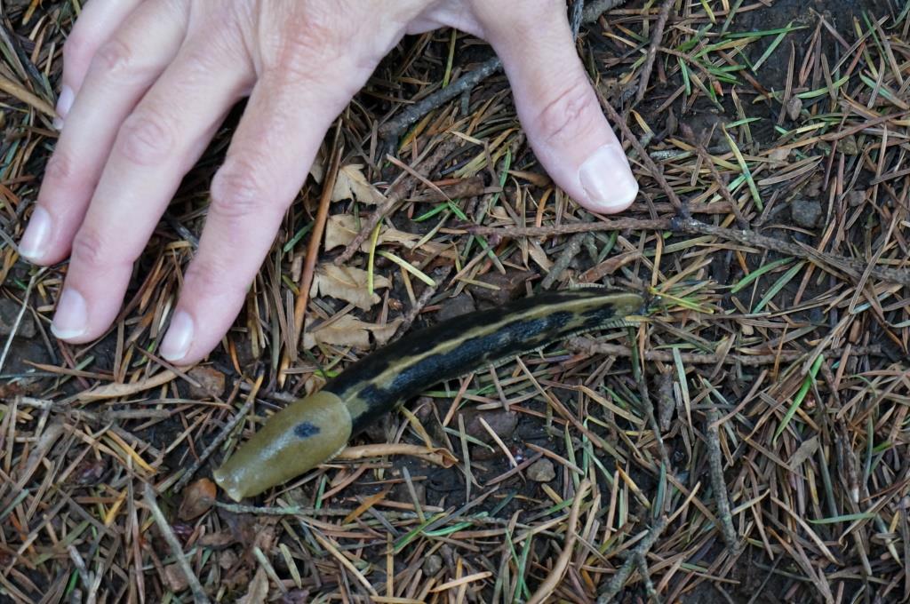
The Ranger on duty was very friendly and helpful and we watched her swear in three Junior Rangers. It made us wish, once again, that our granddaughter was with us enjoying these wonderful parks and learning so many really cool things… like banana slugs. These bright yellow slimy critters are not my favorite thing to meet in the woods but one Ranger explained that they are the heroes of the Redwood forests. They eat everything except Redwood seedlings. They process what they eat and poop it back out as nutrients needed by the forest.

We noticed that these people are really into their slugs. You can buy rubber banana slug magnets (just what I want on my fridge), glass banana slug paperweights, banana slug books, t-shirts and more.

As we walked out of the visitor center we noticed one more car had pulled in… and parked directly in front of our rig blocking our exit. Luckily they came out soon after us and moved so we were able to continue on our way. Next time we plan to point our nose toward the back of the lot so the spaces in front of us are the farthest from the door. We hope to be good unless the lot fills.

Prairie Creek Visitor

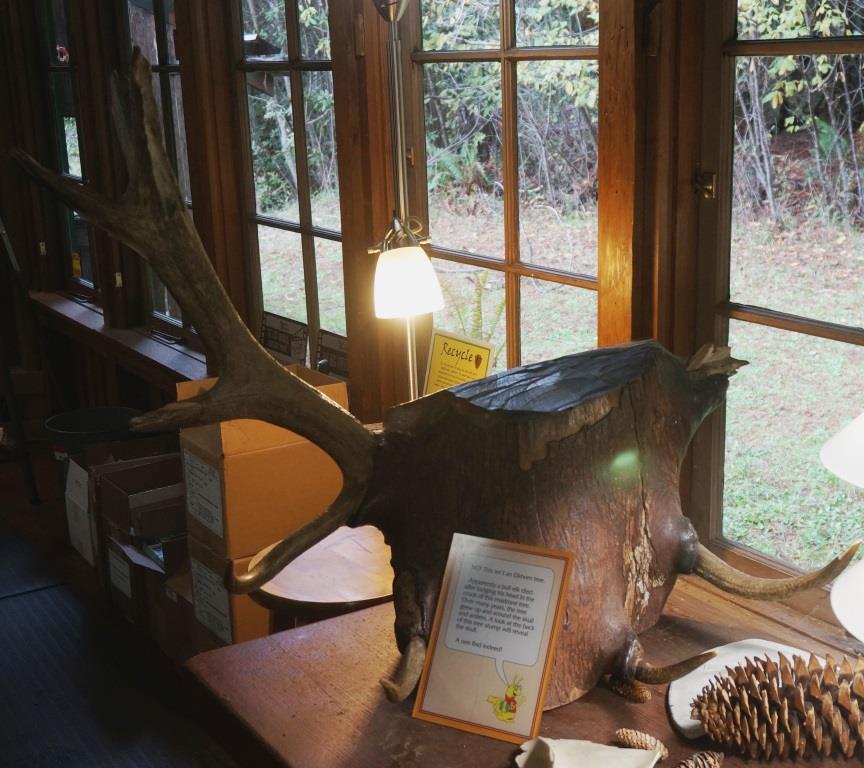
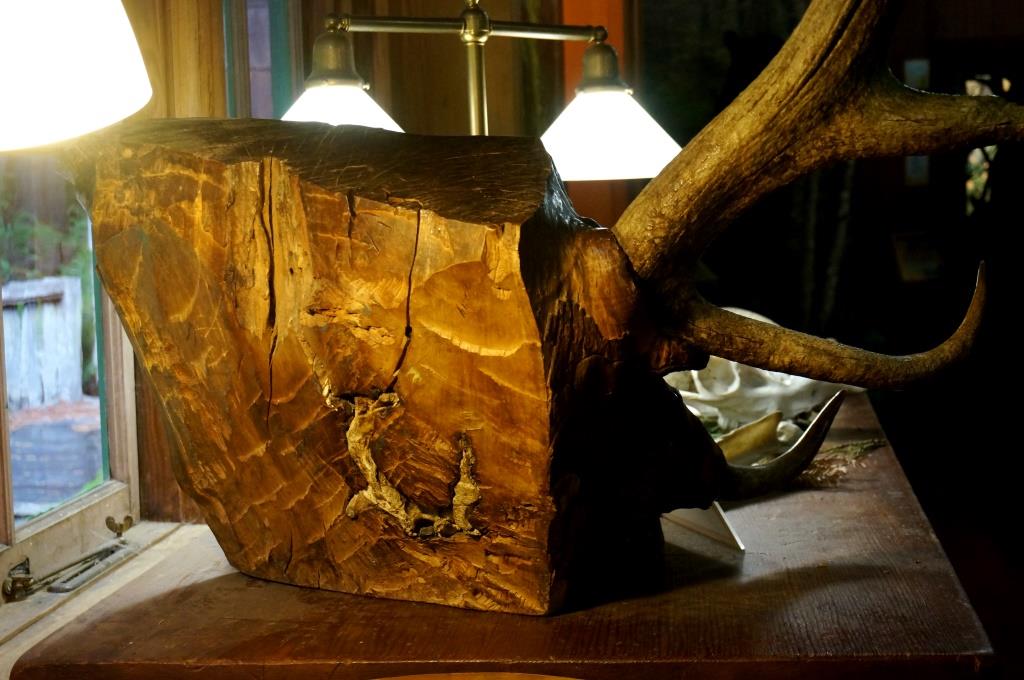
This small visitor center had a display that could have come from Ripley’s Believe It Or Not. See the bull elk antlers sticking out of the tree trunk? How did they get there?

Bull elk horns embedded in tree

Bull elk horns embedded in tree

One theory is that the horns got stuck when the bull shed his antlers.

That sounds reasonable until you cut the trunk down the middle.

That’s when the bull elk’s skull appears.

Bull elk skull embedded in tree trunk

Bull elk skull embedded in tree trunk

The new theory is that the bull somehow got his rack permanently stuck in the tree, he died, and the tree grew around his skull.

As Mr. Spock would say, “Fascinating.” To us at least. Not so much for the bull elk.

This visitor center has the movie room, gift shop (with all the wonderful slug items) AND a cartoon slug with slime trail that kids can follow from sign to sign around the room and learn cool nature facts. Holly, of course, followed the slug. Sometimes the kid stuff is way better than the adult stuff. She read the adult stuff too. It was pretty good but it didn’t have any slugs.

There is an Elk Meadow right outside the visitor center as well as trails through the Redwoods. One of their campgrounds is tucked in just behind the visitor center along the back of the Elk Meadow.
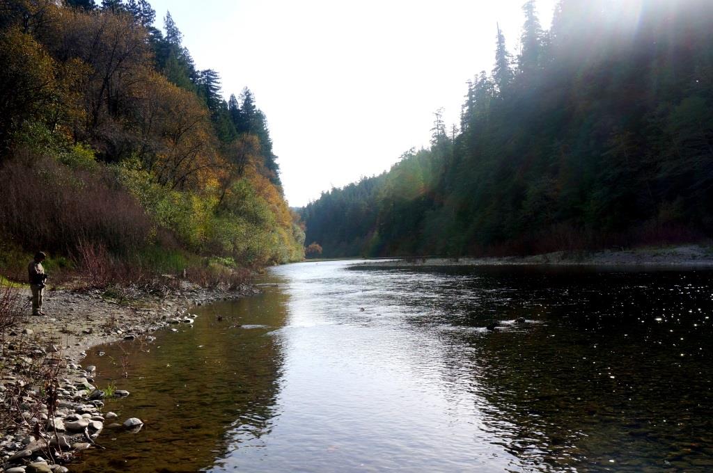
Coastal Drive

Klamath Beach Road, where our campground was located, Alder Camp Road, and the Coastal Road form three legs of a scenic triangle. The Coastal Road was unpaved, full of potholes, ruts, and washboard sections.

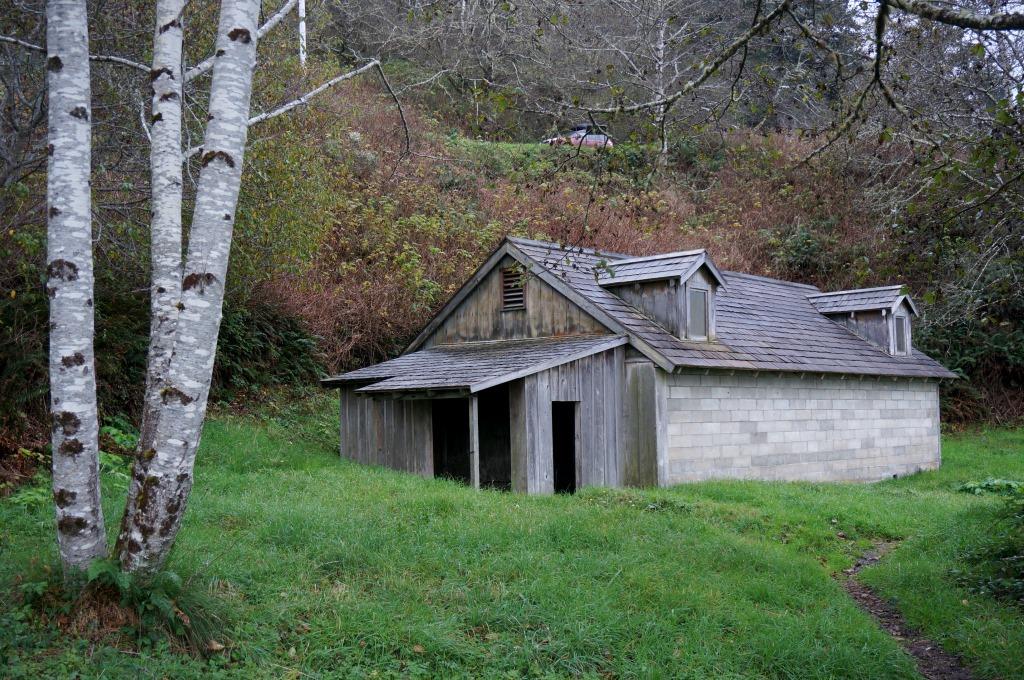
We stopped at one interesting historical site, a World War II era radar station disguised as a farm. Two cinder block buildings, one shown below, with shingled roofs and fake windows and dormers housed a diesel generator, electronic and radar equipment, and two 50-caliber machine guns. You can see the cinder block walls in the picture, but on closer inspection we were able to see where the weathered wood boards were attached on the outside of the block. All sides were covered in wood and looked like a typical farm building. The back of the building has sections of siding still in place.

World War II radar station

World War II radar station

A little known factoid is that on September 9, 1942 a Japanese submarine launched an aircraft off the coast of Oregon. That plane dropped two 176 pound incendiary bombs on a forest outside Brookings, OR, less than 30 miles from this radar site. According to my research, the Japanese were hoping to start a conflagration. Instead the bombs sheared an oak tree, blew up a fir tree, and scorched a small area where the bombs hit.

Campground

We stayed for three days with full hookups at Kamp Klamath, off Hwy 101 just south of Klamath, CA. They accepted Passport America and we saved 50%. They had gravel sites which were fairly level. Our site was flanked by 15 foot pine trees so we had some privacy. Not that it mattered much as there were no more than three other rigs there.

You do have to watch out for the free-range chickens. Fortunately there’s a sign warning you about that. The chickens are very docile, as far as chickens go, and live in an old pop-up camper the owner converted into a chicken coop. Their feed is delivered in a 4-wheeler, which they chased after like children following the Pied Piper.

The owner and office manager were very friendly. The owner gave us half a dozen free-range eggs which were very good. The office manager gave us a bunch of chard, which Holly and I had never eaten. She suggested we saute it in garlic and butter, which we did. We now have a new fresh veggie to add to our “like” list.

There is a quick mart at a gas station just over the bridge in Klamath. They have a few slot machines AND a fast food type place inside. We went in search of Nyquil and returned with dinner and meds. We were pleasantly surprised at how good the fried chicken was. If you need a full fledged grocery store, it is 22 miles north in Crescent City according to the campground manager.

Hiking

Prairie Creek/Foothill Trail/Big Tree

We caught this trail at the Prairie Creek Visitor Center and crossed the scenic parkway.

Like other redwood forests we hiked in, this one had some amazing sites, like this young redwood whose roots reached around and down a nurse log.

Redwood growing from nurse log

Redwood growing from nurse log

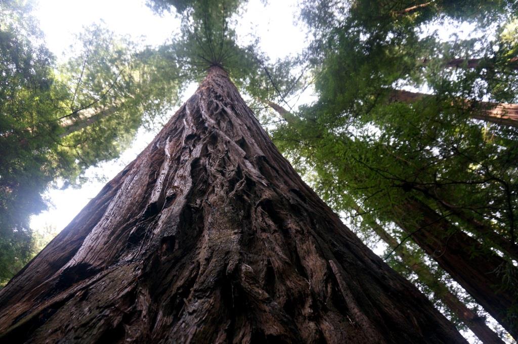
A short side trail took us to Big Tree which is over 300 feet tall and more than 21 feet in diameter. This isn’t even close to being the biggest, baddest redwood. Big enough though. It makes the trees in the forests back home in Maryland look like toothpicks.

Big Tree

Big Tree

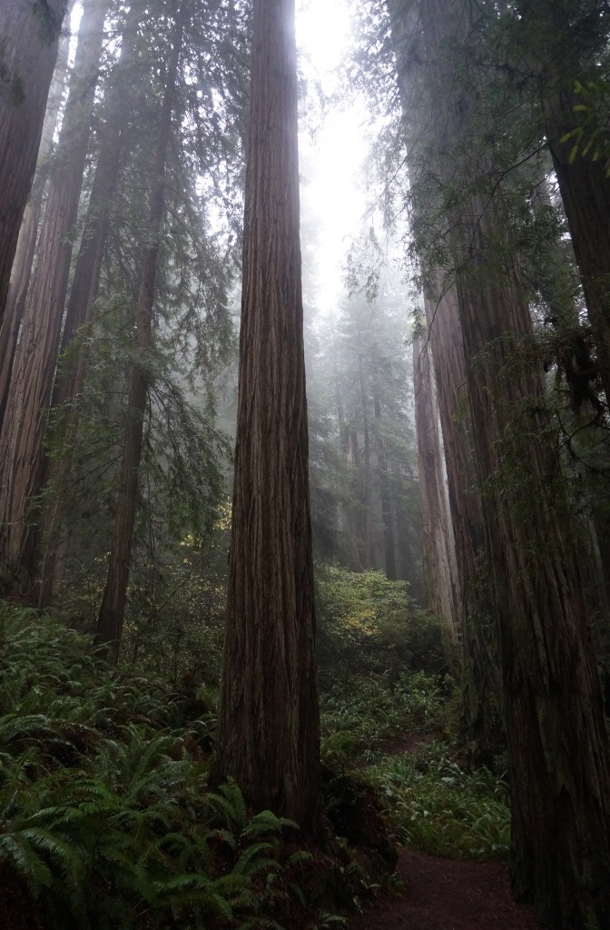
While we hiked, the forest became shrouded in fog. It felt almost primeval. Standing amidst these giants made me feel quite small.

Fog shrouded redwood forest

Fog shrouded redwood forest

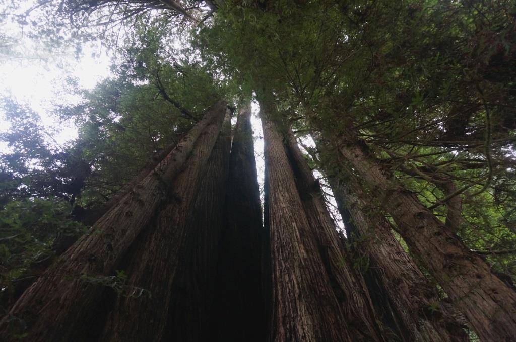
We eventually came across an almost perfect tree circle. These form when the mother tree is injured or dying and she sends out sprouts which eventually become full grown redwoods. These trees surround the stump or the hole where the mother tree lived. This tree circle was huge with a continuous ring of trees around the central trunk. It would be cool to build a platform up inside the ring where you could sit and meditate on the wonders of nature.

Tree circle

Tree circle

Fern Canyon

The ranger at the visitor center suggested we hike the Fern Canyon loop. He said people come to this park JUST to see that. It is a narrow stream valley with fifty foot walls covered in  ferns. Part of it was filmed for use in Jurassic Park II. It sounded interesting so we decided to give it a go. We drove back out and south on Hwy 101 to Davison Road which took us toward the coast. There was another elk viewing area right near Hwy 101 but no elk were there either time we passed. The road was good, paved, reasonably smooth for the first little bit. Then it got narrow and climbed up into the trees. Then it got more narrow with lots of potholes. Eventually we were on washed out dirt and gravel with mudslide piles in the road. This is an out of the way spot for sure, but they do have a self pay station and a campground for tents and vehicles under 25 feet that is right on the ocean. Several of the sites were occupied.

Once we passed Gold Bluff Beach and the campground we had to cross three streams, which we did although we bottomed out on our hitch receiver a couple of times. The Ranger didn’t mention the stream crossings. He must have forgotten. There weren’t any signs about them either until you were right about to go into the stream. The sign said “stream crossing” – well, duh. There’s a wide, deep rut in front of us with a bunch of water streaming across the road. We didn’t need the sign at that point. I guess the people flying through the chuckholes at more than 2 miles an hour might have come up on it quickly and the sign would help them realize slowing down was a good plan but we were already going about as slow as we could go. We were new at this so we crawled through the streams and continued on our drive until we reached the trail head for Fern Canyon.

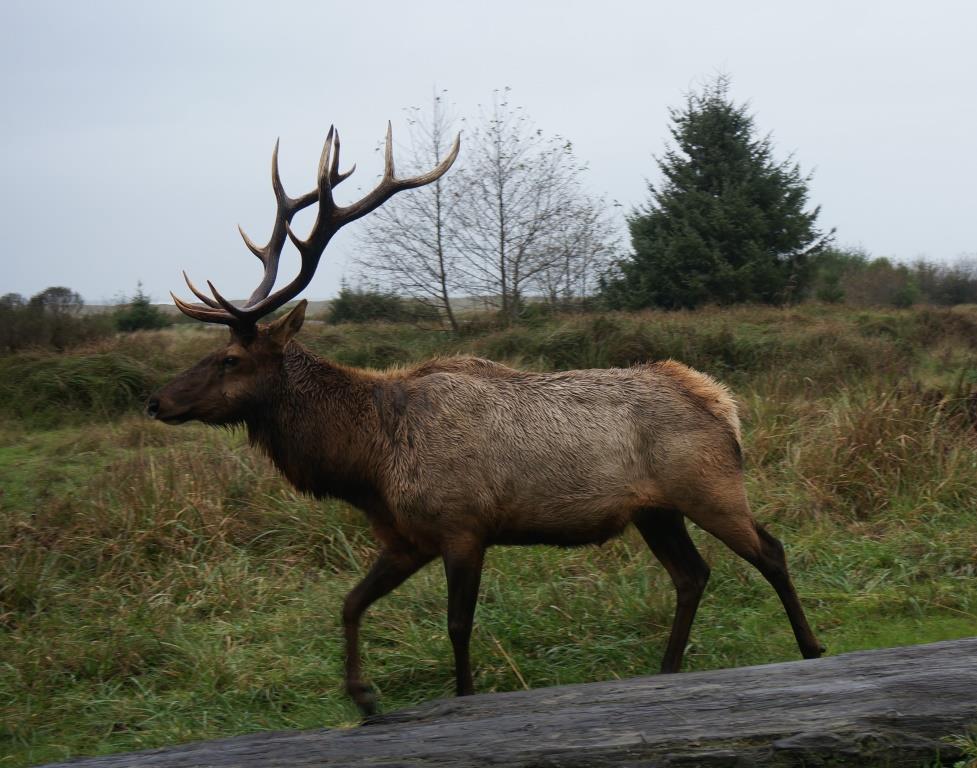
Finally. There we were, checking out a nice trail side sign about the canyon when we spotted a large bull elk grazing about fifty feet away. Wow, cool. Then we saw people approaching on the trail behind him and realized he would want to get away from them… and that there was only one way he was likely to go… which was right over the top of us. Wow, not cool.

We didn’t have a lot of escape options either so we quickly got behind that nice sign and waited while he strolled by on the path right in front of us. He was in no hurry so we got a long look at him from less than ten feet away. He was obviously used to people but was closer than was comfortable so he kept an eye on us and we kept an eye on him. We got a really good look at those huge antlers as he went by. The really pointy antlers that he would use if he saw us as a threat.

We spoke softly, “Niiiice elk. Such a handsome elk. We won’t hurt you,” and avoided eye contact which can be seen as aggression. It didn’t help that the ranger had told us a story about a few of the bulls still being in rut (mating mode, ready to fight). One bull had chased a park pickup truck down the road just a week before. So, here we are, watching those killer antlers go by as we hoped that this guy already got his harem and was just enjoying a nice, peaceful afternoon out by himself.

“Niiice elk.”

Bull elk on trail

Bull elk on trail

Once the bull was safely past us and grazing farther along the road, we hiked out toward Fern Canyon. At this point I’d like to point out a few other things that the ranger “forgot” to mention. First, the ranger did not tell us that the trail is not well marked. At no point is there a sign that says “Fern Canyon” or “Fern Canyon Loop Trail” (like it says on the map he gave us). We saw a trail shortly after crossing a stream and took it. Luckily it was the right one. Second, the ranger did not tell us that there is no trail for half the loop. You hike in the stream. We’ve hiked in a river before and it was awesome but we knew we were going to do it then. We were not prepared for this one.
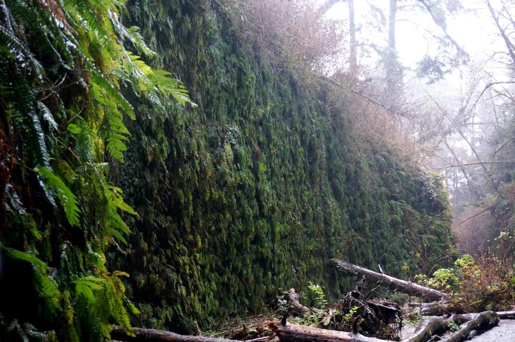
Fern Canyon

Fern Canyon

The canyon was very narrow, maybe 50 to 100 feet wide with walls about 50 feet high. Even with the rain and fog, the fern-covered canyon walls were pretty neat. Five types of ferns draped the canyon walls but we couldn’t tell them apart. There were tons of downed trees in the canyon so we were constantly crawling under and over tree limbs in between crossing the stream. when we were about half way down the canyon it started to pour. There we were slipping on downed trees, rock hopping across the stream AND trying to take pictures without soaking the camera (because the waterproof camera was back at home safe, sound, and dry of course).

Once we hiked out, stuffed our wet muddy bodies into the car, crawled the Subaru back out through the streams and chuckholes and headed up the road, Holly expressed a desire to go back and smack that ranger upside his head for his “forgetfulness.” John was driving and he said no.

So, if it is a beautiful, sunny day and you want to wade in a creek and check out a very cool canyon, this might be the hike for you. Make sure you are in a high clearance vehicle and your map has actual trail names on it.

J & H

Posted in Campgrounds, Hiking, Parks | Tagged , , , | Leave a comment

Humboldt Redwood State Park

November 15-18, 2014

The Avenue of the Giants is a spectacular 32-mile long two lane road that runs through an old growth redwood forest. The road winds its way around redwoods growing inches from the edge of the road. Although we could have taken Route 101, which roughly parallels this road, we were glad we didn’t.

Avenue of the Giants

Avenue of the Giants

Much of the road is in the Humboldt Redwoods State Park. According to the park brochure, the park “harbors the largest remaining old-growth redwood forest in the world.” We spent three very enjoyable days there.

Burlington Campground

The campground was tucked in an old growth redwood forest. Although we didn’t have a reservation and half the campground was closed off, we still found an awesome campsite.

Our campsite

Our campsite

As usual for California state parks, we had no hookups. That wasn’t a problem because the weather was fine – not too warm during the day and not too cold at night.

The campground had bathrooms and pay showers, neither of which we used. We are now boondocking veterans. “We don’t need no stinkin’ showers!”

There are two other campgrounds in the park, Albee Creek and Hidden Springs, both of which were closed for the season.

Visitor Center

The visitor center was a short walk from the campground and had quite a few interesting indoor and outdoor exhibits.

One outdoor exhibit in particular caught my attention. The tree shown below fell in December, 2006. It was “born” in 912 AD.

Redwood lifeline

Redwood lifeline

The tags on the tree mark events in human history that occurred during this tree’s lifetime.

Human history In the lifetime of a redwood

Human history In the lifetime of a redwood

This tree was almost 90 years old when the Vikings landed in North America in 1000 AD. By the time it fell, this tree’s life had spanned something like 50 human generations. Pretty impressive, huh?

The visitor center had the usual gift shop that sold T-shirts and sweatshirts, souvenirs, books, DVDs, and trail maps.

The museum was divided into several sections. One covered the history of the creation of the park.

Part of that history was made by a man named Charles Kellogg. He took a 22 foot section of an 11 foot diameter redwood tree and created the Travel-Log.

Charles Kellogg's Redwood Travel-Log

Charles Kellogg’s Redwood Travel-Log

The large stuffed bear in the driver’s seat is a cute touch. The Travel-Log was basically a homemade motorhome with a bed, chest of drawers, wash basin, and cooking area.

Using his Travel-Log, he began his crusade to save the redwoods in October, 1917. While he was at it, he also sold War Bonds. (The U.S. had recently entered World War I.)

Charles Kellogg had another talent – the ability to reproduce bird songs. There was a recording of him singing bird songs and I have to say it was very impressive. Apparently his records were best sellers back then.

Another section of the visitor center covered the massive 1964 flooding of the Eel River that devastated the area, wiping out several small communities. There were binders with copies of old newspapers that covered the event. Being a news junky, I had to flip through the binder. Photos of the devastation were astounding. We also saw poles along the Avenue of the Giants that showed high water marks from the flood. Some are 25 to 30 feet above the road, which is at least 10 feet above the river. I did some research and the flooding stretched from California’s Central Valley to the North Coast and up the coast of Oregon.

The third part of the visitor center covered the natural history of the area. The more I learned about these trees the more amazing they became.

  • Redwood forests existed as far back as the late Jurassic period (think dinosaurs).
  • Its bark can be up to one foot thick and protects the tree from fire and insects.
  • It contains tannic acid which deters insects and retards decomposition.
  • Burls, large knobby bulges, growing on the tree contain hundreds of clones. If the tree becomes stressed, the clones begin to sprout.
Redwood burl

Redwood burl

  • Its canopy forms its own ecosystem, supporting ferns, mosses, shrubs, salamanders, and birds.
  • It has two types of needles – round needles up top to absorb moisture from fog and flat needles at the bottom to catch light.

Hikes

Most of the trails were level and about 4 to 6 feet wide. For the most part, elevation changes were imperceptible.

The South Fork of the Eel River, which the Avenue of the Giants followed, was a short hike from the campground.

South Fork of the Eel River

South Fork of the Eel River

At this time of year, the river is fairly wide but shallow and slow flowing.

That’s not always the case, especially in the winter when the rains come.

The trail to the river also intersected the Gould Grove Nature Trail (0.62 miles). I walked in awe among these forest giants.

 John dwarfed by redwoods

John dwarfed by redwoods

The thick forest and needle-covered floor dampened sound. Everything seemed quieter and subdued. Sunlight filtered through the canopy. The air was damp and cool. I felt as though I was in nature’s cathedral. A very serene place.

The Founder’s Grove Nature Trail was 0.53 miles long and took us to the Founder’s Tree which topped out at 346 feet high and 40 feet in circumference. Holly just had an urge to hug it.

Tree Hugger Holly

Tree Hugger Holly – can’t quite reach all the way around this one!

It’s almost impossible to capture the enormity of these trees, but I tried.

Looking up a Redwood's trunk

Looking up a Redwood’s trunk

The longest trail we hiked, at 2.4 miles, was the Drury-Chaney Trail. I thought it was also the best. In addition to the redwoods, the ground was covered in redwood sorrel (three-leaf clover-like plants) and large ferns. While walking on this trail in the late afternoon light, I felt as though I was in Jurassic Park. I could have been too because these trees’ ancestors lived with the dinosaurs.

Jurassic Park forest

Jurassic Park forest

This was a fascinating and awe-inspiring place. Go there if you can.

J

Note from Holly – we watched a 45 minute National Geographic video at the visitor center that was quite good. One section showed how they photographed one of the giant redwoods by stringing up a camera and lowering it down to the ground. The photo was a five page centerfold fold out in one of their magazines and can be found here http://ngm.nationalgeographic.com/redwoods/gatefold-image

Posted in Scenic Drives | Tagged , , , , | Leave a comment

Fort Ross

Monday, November 10, 2014

Somebody call Sarah Palin! There’s a Russian fort on the California coast! They’ve got cannon and muskets too!

It’s true. I swear.

There was a Russian settlement in northern California, built in the early 1800s. Just far enough north so as not to alarm the Spanish who settled up to the San Francisco area and far enough south to keep the British in Canada at ease.

I did not know this. I knew the Russians had settlements in Alaska, but not in California. I learn something new every day. It’s not that hard as there’s so much I don’t know. And what I do know is usually wrong.

While England, France and Spain traveled west across the Atlantic seeking new lands and riches, Russia went east and by the late 1700s had established a number of settlements in what is now Alaska. The biggest problem was that these settlements were not self-sufficient. Food and supplies had to be shipped from Russia. Shipments could take up to two years to reach Alaska. Another problem is that the most sought after fur-bearing animals, especially sea otters, had been hunted to near extinction.

Which is why 25 Russians and 80 Aleut fur hunters, commanded by Ivan Kuskov of the Russian-American Company, came ashore at Sandy Cove in the spring of 1812.

Sandy Cove

Sandy Cove

The purpose of this settlement was to provide food and materials to Russia’s Alaskan settlements and to hunt sea otters for trade. (A ranger let me touch a sea otter pelt and it was extremely soft and luxurious.)

Over the following months, the fort and buildings were constructed to withstand a Siberian winter.

The fort consisted of outer walls with two blockhouses, one seven-sided and the other eight-sided, on opposite corners.

Seven-sided blockhouse

Seven-sided blockhouse

While Fort Ross successfully grew cabbage, lettuce, carrots, turnips, beets and other crops, they had less success with wheat, which is what Russia’s Alaskan settlements really wanted. At its peak, Fort Ross only provided half of Alaska’s wheat. Fort Ross also raised cattle, horses, sheep and pigs.

As for hunting, they obviously didn’t learn their lesson because they also hunted California’s sea otters almost to extinction.

In addition to food and furs, Fort Ross built ships and other boats, made barrels, manufactured bricks, harvested lumber, and repaired guns and other equipment.

Despite trading bans by the Spanish and Mexican governments, trade between Fort Ross and Californios farther south flourished. Trade items included grain, beef, cloth, tools, coffee, tea, sugar, tobacco, boats, iron products, and leather.

The Russians built a storehouse, called a magasin, for their trade goods.

Magasin

Magasin

The park had recently completed the reconstruction of this building. Because the Russians kept such good records, the park filled the magasin with goods that the Russians would have had in stock.

Interior of magasin

Interior of magasin

Another view of interior of magasin

Another view of interior of magasin

Other buildings that were constructed included the Kuskov house and an Orthodox church. Note the two cannon in the foreground.

Kuskov house and Orthodox church

Kuskov house and Orthodox church

Additional buildings included barracks and officials quarters (building on left) and the Rotchev house (building on right). Alexander Rotchev was the last administrator of the fort. Ivan Kuskov was the first.

Barracks and Rotchev house

Barracks and Rotchev house

It took almost 30 years, but the experiment failed and Fort Ross was sold to an American.

J

Posted in History, Museums | Tagged | 2 Comments