November 9-15, 2014
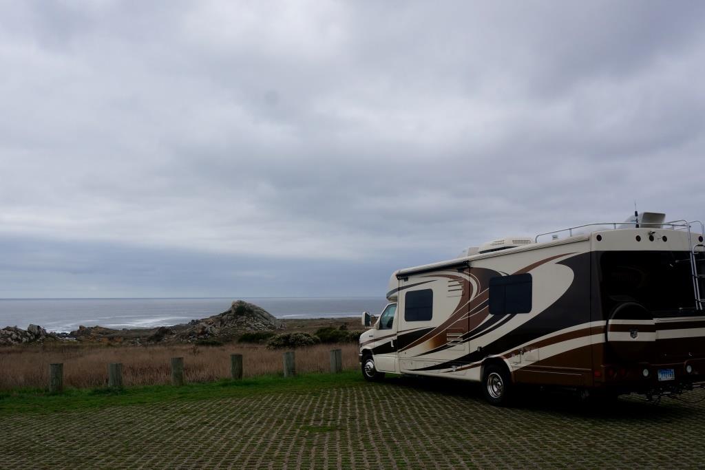
We drove this portion of Route 1 in our 28′ Motor Coach towing the Subaru – driving North (which is the NON cliff side).
We left Napa and headed west on a beautiful sunny day. We knew that Route 1 would have lots of curves and that we would need to drive slowly and cautiously but we were ready. We’ve done the twisting mountain roads several times before so we felt qualified. As we approached the final rise of land between us and the ocean we spotted a blanket of fog flowing over the hill and through the gaps. Hmmmm… forgot about that.

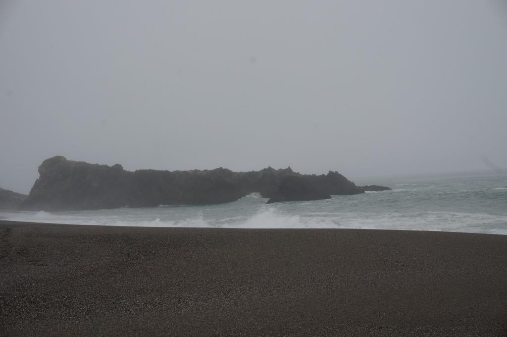
Blanket of fog – no ocean view
The fog was not bad, more just wispy bits at ground level, but it almost totally obliterated the ocean. We could drive safely enough, we just didn’t have any nice views. We hadn’t been on the road long but decided to call it a day and hoped for clearer skies tomorrow. We think we got maybe ten whole miles on Route 1.
Foggy Beach
Sonoma Coast State Beach
The sign said “campground full” but we crawled down a winding road to Sonoma Coast State Beach – Wright’s Beach Campground and were lucky enough to get a site in the full campground as someone had to leave early (thank you Lady Luck!)

Sonoma Coast SB
We were camped right on the beach with just a few scrub trees between us and the open beach area. We enjoyed wandering the beach and loved the sound of the waves as they lulled us to sleep. John tried for some good sunset shots and I think they are nice, if not the usual. The combination of fog and clouds is pretty cool in a sort of dark, sinister, and pink kind of way.
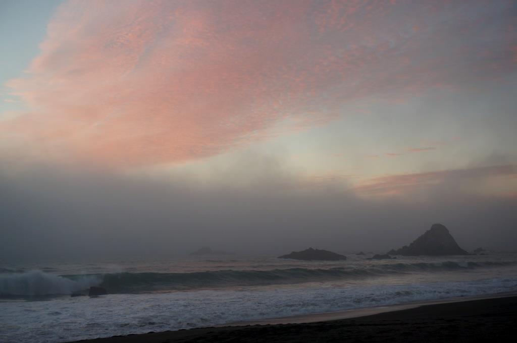
Foggy Sunset
We woke to even heavier fog but needed to move on since the sites were all reserved that night. The fog was still not bad on the road but, again, no views. The road does twist and turn a lot and there are several sets of hairpin turns that get you up and around the river valleys but the drive wasn’t bad. No white knuckle grips were needed.

Hairpin Turns
John had to watch the road and only the road so even if there wasn’t fog, he wouldn’t have been able to enjoy the views. We did pull over a few times and enjoyed what we could see of the coast (see, there it is, straight down). Most of the pullovers were on the southbound side so we only stopped a few times between our overnights. We also pulled over when there were turn outs to allow cars to pass but those were usually not in scenic areas.
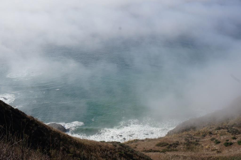
The Ocean peeks out far below
We drove a bit then stopped in at Fort Ross (see separate posting). Museums, visitor centers and historic sites tend to take us a good bit of time so it was afternoon before we left and we immediately started looking for a spot to camp. We settled on Salt Point State Park, just up the road from the Fort (the Fort has a campground but it was closed). We figure we made it about ten more miles on Route 1… and decided we are OK with that. We didn’t figure to go this slow, but we’re enjoying it and aren’t in a hurry.
Salt Point State Park
This park has two formal campgrounds, one on each side of Highway 1 with overflow camping in their day use lot. We were hoping we would get into a site near the ocean so we could watch and listen to the waves again. Since it is off season, the booth was unmanned and there were signs up instructing us on how to self-register. We had a spot of luck as a ranger drove up just as we did. He saw our receipt for Fort Ross stuck in the window and told us to take that admission price off of our campsite fee. Then he told us we had the option of camping in the overflow lot right near the ocean since we are fully self-contained – we just couldn’t have open fires. We checked it out and jumped on it. It is just a parking lot with grassy pavers but we could see and hear the waves from our windows.
Overflow Lot
The standard camp fee for this park is $35.00/night or $30.00 for the overflow lot. We deducted $2.00 for John being over 62 then another $7.00 which was the discounted fee we paid at Fort Ross so we stayed for $21.00 that night. We had the use of the restrooms at the day use area if we wanted them and I suspect we could have filled our tanks with water in the upper campground if we needed to. We really just needed a safe place to overnight and we got that PLUS the awesome ocean views.
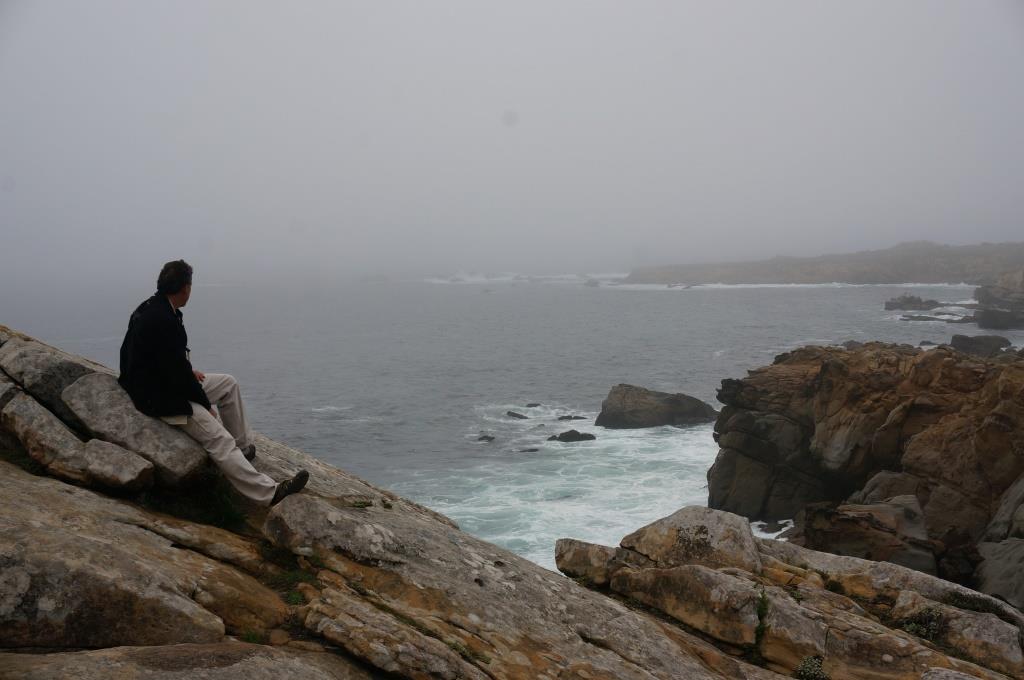
John in his Element – mesmerized by the waves
We both love the crashing waves on the rocks but it totally mesmerizes John. He just stops and watches and time slips away. We wandered the seaside trails and watched the wildlife as well as the waves. The fog seemed to ebb and flow and at times left us in a clear bubble with fog curtains all the way around us. We never had trouble seeing things in our immediate area, we just couldn’t see outside of our “snow globe” bubble.
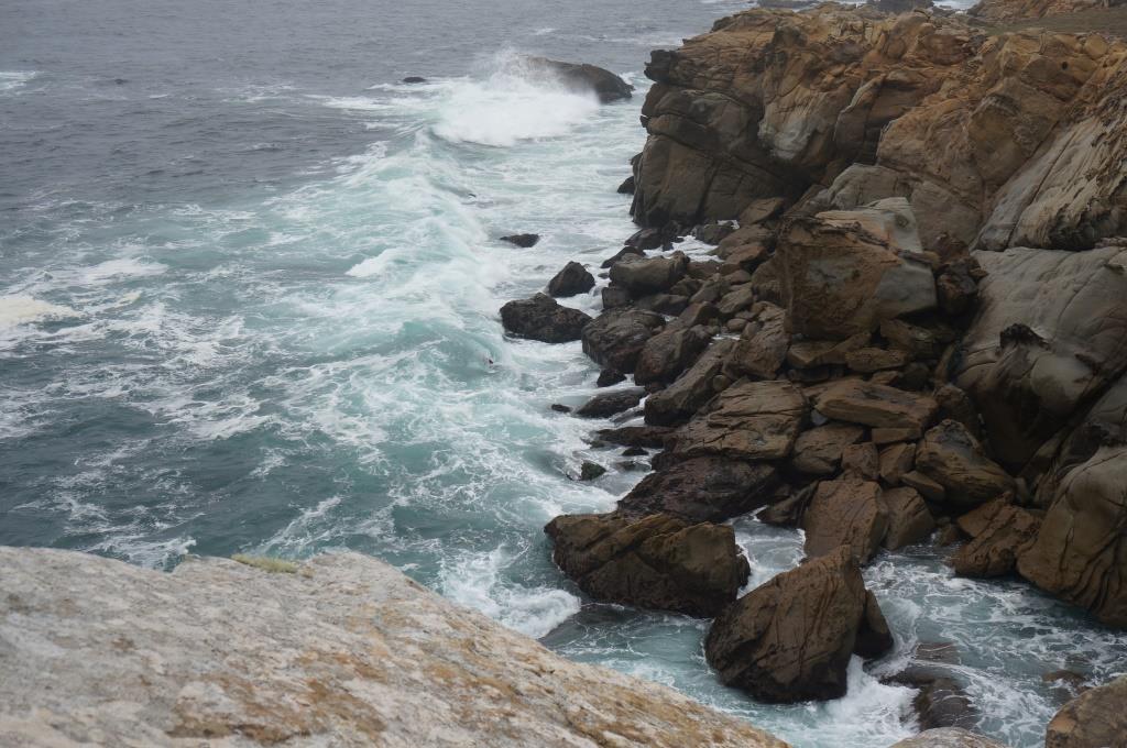
Gorgeous Rocky Coast
There were plenty of open sites in the regular camp loops and they looked decent (not too level but not terrible) with lots of trees, a restroom and water. There is no dump station in the park and no hookups even in the formal campsites. There was a camp host up there but it was just us and two more campers in the overflow lot.
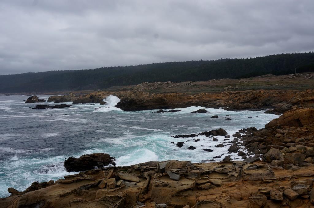
Shoreline
The visitor center was closed when we were there and low tide was after dark so we didn’t get to check out their tide pools.
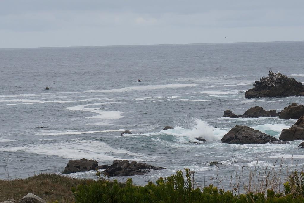
Kayakers in the Surf
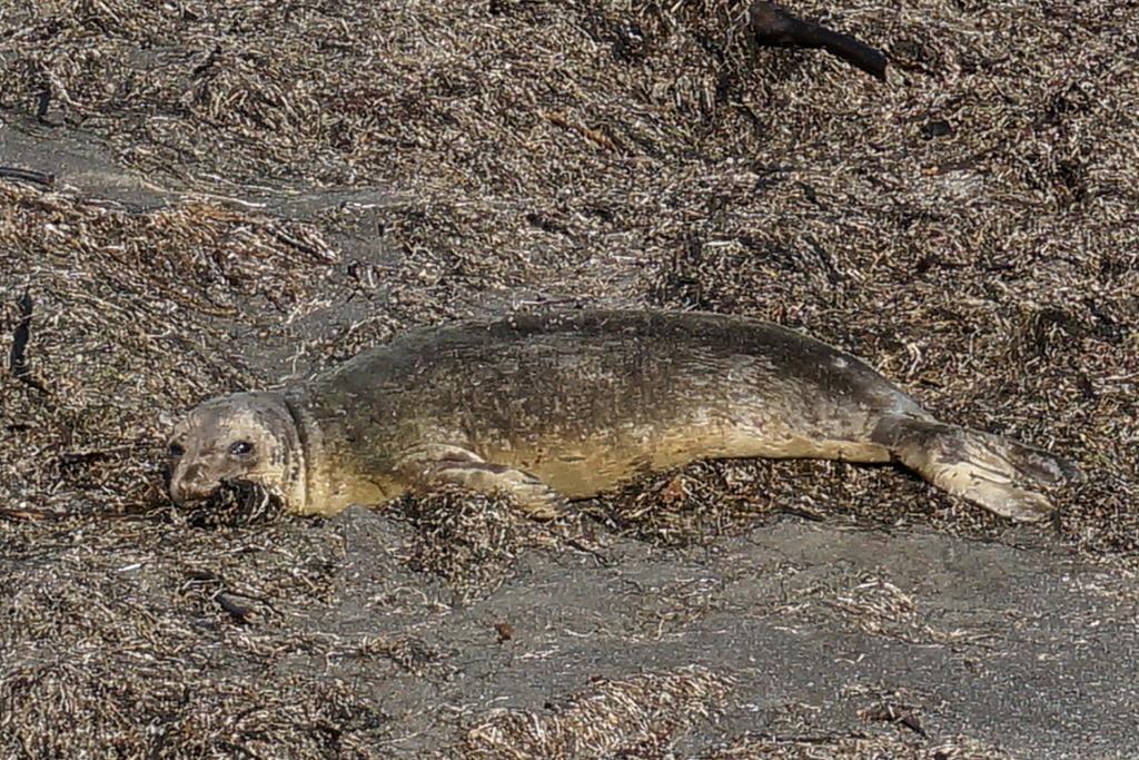
We did see kayakers off shore, lots of shore birds and some seals. One seal kept watch on us from the water and three were hauled out on a rock relaxing.

Seals on the Rocks
Seals and Sea Lions seem to be extremely good at relaxing. We hope to copy that behavior and become very mellow as we travel along.
We woke to a visible horizon; the first we’ve seen since we hit the coast. After I delayed things by chatting with the neighbors, we headed out with the intention of making it more than ten miles this time. We did well but that is partially due to the road moving inland for several sections so we were able to get a little closer to the posted 55 mph speed limit they have on Highway 1 (on those curves, with the cliffs, 55, seriously???) We made it all the way up past Fort Bragg and landed in another very nice state park (Fort Bragg the town, not Fort Bragg the military base – that one is near the other coast – we aren’t that lost… yet).
MacKerricher State Park
The first thing we saw was a whale skeleton. This is very cool but eventually I want to see live whales… lots of whales. They should be coming through here in the next month or so on their way to the southern feeding grounds. We’re watching for them.
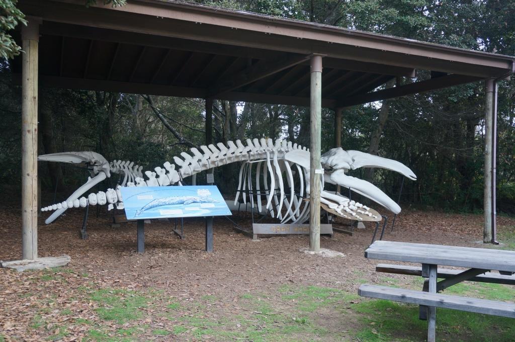
Gray Whale Skeleton
The next thing I saw was that they have a whale and seal observation deck. How cool is that? We spent a good bit of time out there just watching the seals and tides, and birds and ground squirrels. And they watched us. As we strolled the beach we realized we were being watched by a seal just out in the first waves. He followed us all the way along the beach, ducking under when he saw us looking back, then popping up to follow again.
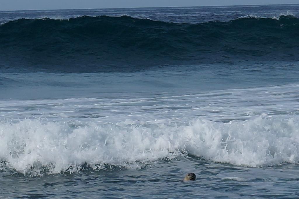
Curious Seal – watching us
As we crossed the rocks and continued on down the beach we realized we were being watched by a whole mess of baby sea birds. They nest on the shore there and these juveniles seemed to be under the care of only a few adults.

Lots of Baby Sandpipers – watching us
As we strolled the boardwalks out to Laguna Point and the tidepools we realized we were being watched by really cute ground squirrels.
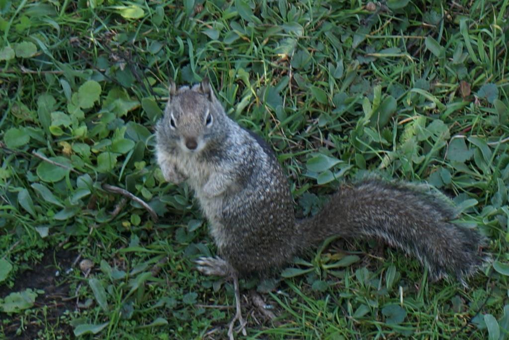
Ground Squirrel watching us
So, if you are paranoid about being watched, this is not the park for you. The critters are everywhere and they were certainly keeping an eye on us two legged intruders.
At one point we saw signs saying “Marine Mammal – stay back, don’t disturb”, etc. I looked and looked and then realized there was a seal on shore right in front of me. He/she blended in with the dried sea grass washed up on shore. We don’t know if it was sick or pregnant or just tired. We’re hoping just tired and that it will swim happily away after its nap. Note that it is keeping a close eye on us.
Seal resting on shore
I wonder if all these critters are out there looking our way and saying “Look, there’s more of those things with funny flippers… I think they’re watching us”.
We really like this park. There are three camping loops and we chose the West Pinewood Campground because it is so close to the ocean (See a pattern here? John likes the ocean so I find sites as close as we can get to it.) We have a big, beautiful site under the pine trees with easy access to water, restrooms, pay showers and eventually, the dump station. They have a paved “Haul Road” multi-use trail that takes you up along the rest of the park or down into Fort Bragg itself. We can access it easily from the campground. We walked part of the trail and discovered that fall comes to the ocean shores also. I never expected to find the autumn reds, golds and greens in the ground cover along the beach but there are banks of it.
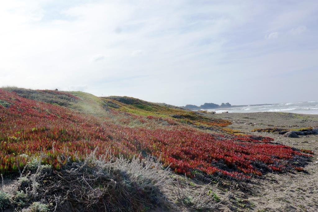
Autumn at the seashore
The park also has a good size lake, Lake Cleone, where you can fish or paddle around if you have a kayak. We hiked the trail only to find that the boardwalk areas are closed until renovations can be done. It will be a beautiful stroll when they finish it.
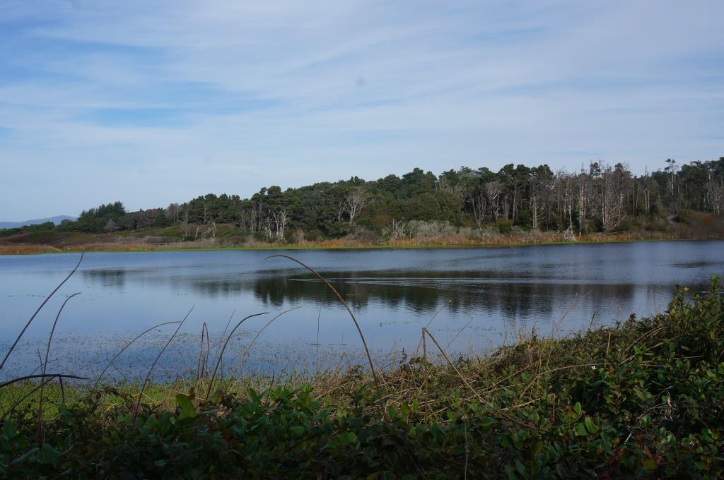
Lake Cleone
Restaurants
We ventured into Fort Bragg for food several times. The first time we ate at Mendo Bistro. It was OK, not great and overpriced. If I’m paying $25.00 for a small piece of chicken, it should NOT be served with grainy, runny, instant mashed potatoes even if they are “flavored with buttermilk”. Our next meal was far better and is just across the side street from the Bistro. We had an excellent pizza at Piaci’s Pub and Pizzeria. It is very small, very loud, very crowded and obviously a favorite hang out for locals. The beer, pizza and service were all good and we would definitely eat there again. Note that Piaci’s and several other restaurants are cash only. Some will take a personal check as long as you write your phone number on it. You should verify this first. We luckily had enough cash on us to cover the bill. We also dined at the Purple Rose Mexican restaurant just next to the campground. It was OK, not great, but reasonably priced. This restaurant only took cash or checks, no credit cards. They took our check even though we are out of state. They were also really crowded and had a lot of locals so maybe we just ordered the wrong thing. We’re pretty good at doing that.
H