
September 21-23, 2014
We approached the canyon from the east, driving along through the Curecanti National Recreation Area where we could see the placid, dammed Gunnison River beside the road. Surely that isn’t the river that carved a massive gorge?
Our first look over the rim confirmed that little river was truly at the bottom. The river has been tamed by several dams but it still rules the canyon. And WOW – this is one beautiful canyon. It isn’t the Grand Canyon but it certainly holds it own. It is deep and narrow like a giant crack split the earth and the little Gunnison River dropped into it. In reality, that little Gunnison River carved this impressive thing. Like I said – WOW!
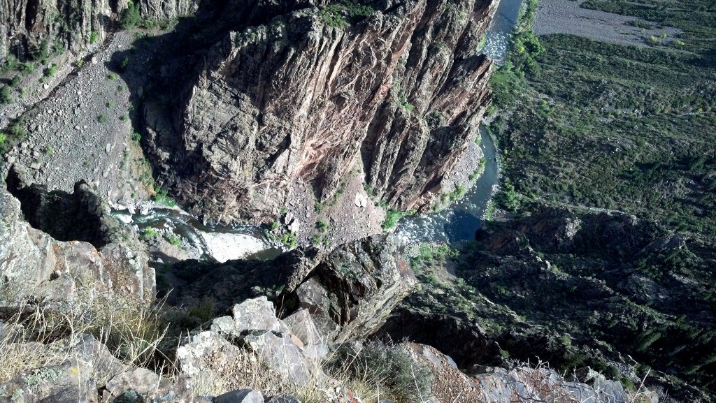
View down to the Gunnison River
There is a beautiful visitor center perched on the edge of the Canyon where you can talk to a ranger, watch a movie, check out the 3D map of the park, learn about the canyon and buy maps, souvenirs and gifts. You can also access several hiking trails and an overlook that hangs out on into the canyon on a ridge of rock. There is a water spigot outside and it is recommended that you take water with you even on short hikes.
There are many overlooks along the rim road. A few barely require that you leave your car but some have decent hikes across the rocks to get out to the overlook. Several of the overlooks give you an excellent view of the Painted Wall. This is the highest cliff in Colorado. The pink bands of rock flowing through the darker stone walls is Pegmatite. It is a beautiful deep pink rock with sparkling crystals in it.
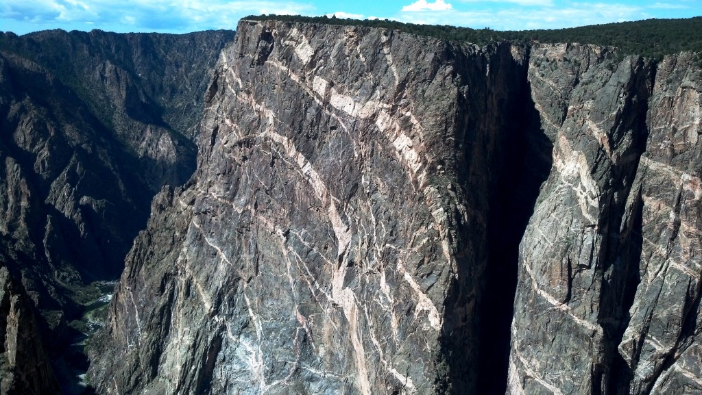
The Painted Wall – highest cliff in Colorado
We hiked every trail on the South Rim that didn’t require a wilderness permit. Don’t be impressed, there aren’t that many, most only go out to overlooks (OK, John hiked every one, I sat out a few in the heat of the day).
The Warner Point Trail (1.5 mi.) has a nature trail booklet that was really good and the view at the end of the trail is amazing and the gorge is 2,772 feet deep at the point. It is well worth the hike.
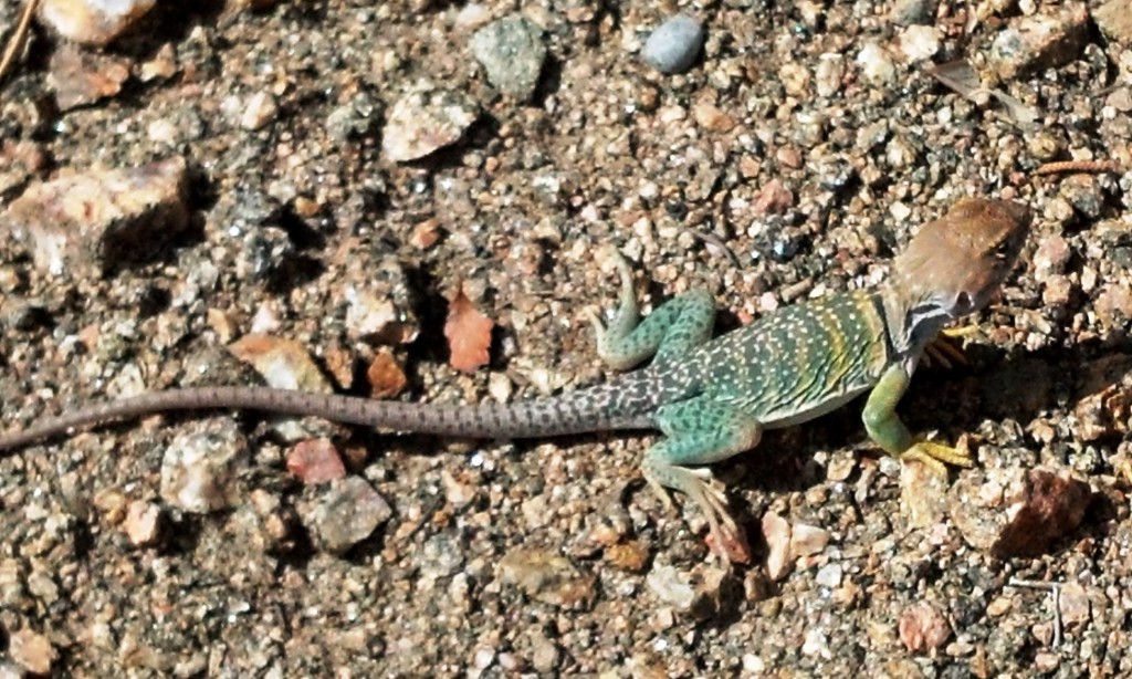
Lizard we met along the trail
The Rim Rock Trail (1 mi/1 way) runs from the campground to the visitor center and is also very good and runs the upper edge of the canyon just below the road.
We were less impressed with our return trip on the Uplands Trail (1 mi/1 way) which was just trudging through the juniper and pinion pines in the heat of the day. I wilt in the sun so I would hike from little shade patch to little shade patch and rest at each. John was very patient with me and we did eventually get back to camp.
The short and steep Oak Flat Loop drops you 400 feet down into the canyon but doesn’t really give any better views than you can get from the rim. It is fairly steep in places but it gets you as far down into the canyon as you can go without the wilderness permit (unless you access from the East Portal Road). At the lowest point of the Oak Flat Loop another trail leads off down to the river. The trail called to us and we stared at the sign for a while but we did not have the required wilderness permit. We probably would have been hard put to climb back up out of the canyon, but it sure was tempting (we frequently are not as bright as we look).
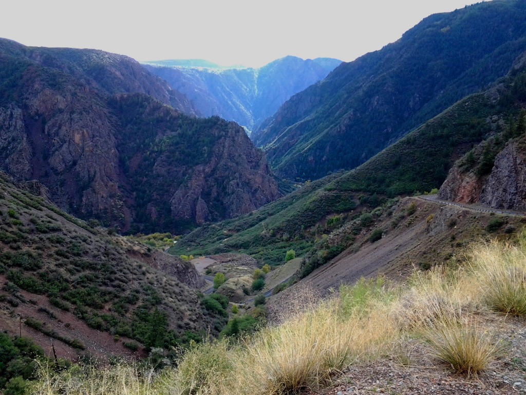
East Portal Road
Speaking of the East Portal Road. There’s another WOW! Vehicles are limited to 22 feet for very good reason. The road starts mildly enough with cattle grazing across it in the open range section (they stare, they moo, they chew – such pretty eyes) but once it drops over the edge – hang on. We had hoped to get a good picture of the hairpin turns but they are so tight that you can barely see one level down from the edge of the level you are on. The road is at a 16% grade. Our Subaru took it like a champ and earned its keep once again. There is a place to pull over part way down in case you need to rest your gears, brakes, knuckles, whatever. It’s also a good spot to take a picture.
Once down, there are signs explaining how an entire town was built down there and their road was steeper than the one that exists now. All those people were there to build a diversion dam and tunnel. That would be a 5.8 mile long, 11 foot x 12 foot tunnel through the sheer rock wall of the canyon so they could get water to the Uncompahgre Valley. Unfortunately all you can see is the diversion dam and the little building that sits over the opening of the tunnel.
I forgot to mention that this area, with a nice campground along the river, is in the Curecanti National Recreation Area. The only road comes in through the National Park and it dead ends at a bigger dam a little way upstream. There were several fly fisherman standing in the river happily fishing. What a gorgeous place to fish!
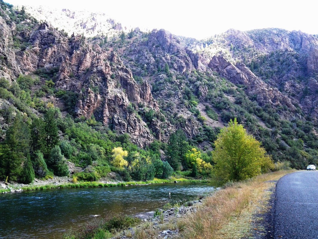
Fly Fisherman – look closely, he’s there
The Curecanti also offers a boat tour of the Gunnison Canyon that several people recommended highly but they had closed for the season by the time we got there. The boat is accessed from way over in the Curecanti National Recreation Area. If you are interested, check their website first. I read you have to go down several hundred steps and hike a distance to the boat launch so it is an adventure before you even reach the boat. Then, you have to get back up again.
Campground – We stayed at the south rim campground. It is a little back from the edge of the canyon but the Rim Rock Trail leads off below the rim where you can sit and gaze into the canyon below. If you continue 1 mile on the trail, you’ll reach the visitor center. The campsites were good size and reasonably level and very empty. We had no problem finding a nice shady site to tuck into (Site B20). The “B” loop had electric hookups and the days had been hot so we paid the uplift and camped there. The restrooms are somewhat smelly pit toilets and there is water available but a sign at the spigot states “This water has been hauled 14 miles, please conserve”. There are dumpsters for recycling and trash but no dump stations. NO phone signal. Our booster did pick up a bit of an intermittent signal but could not lock on. We did not wander the campground checking for better spots. We just enjoyed being unplugged. The mule deer wander through the campground ignoring the humans and the chipmunks basically own the place. We saw several rabbits and one, cute little baby bunny that tucked itself into the brush and “froze” when we came near. Bear and mountain lion warnings are posted throughout the campground but there were no sightings while we were there. It is a nice campground and we enjoyed our stay there.
H

We visited the Black Canyon in the Spring a few years ago. The black walls of the Canyon really set off the colors of the wild flowers. We would love to go back, this time in the RV, so thank you for the campground notes!