Mesa Verde National Park
September 24-25, 2014
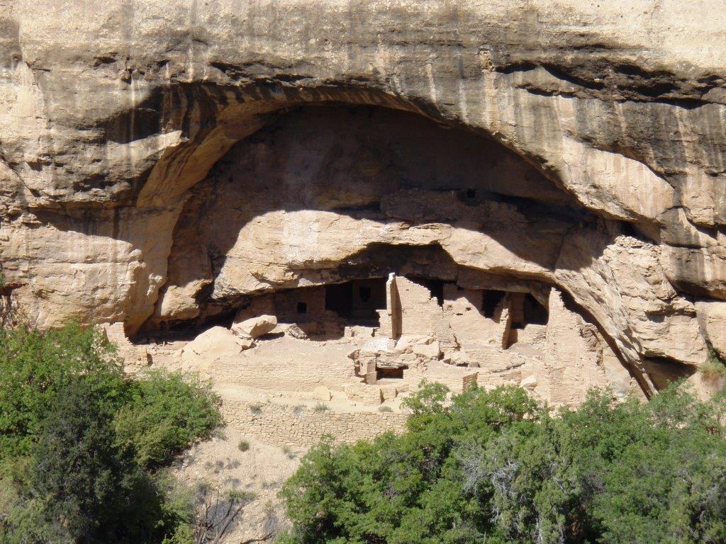
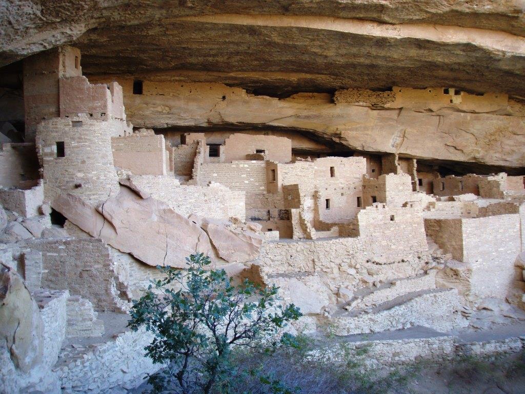
Spruce Tree House
We visited Spruce Tree House on our first day in the park. No sense in wasting time.
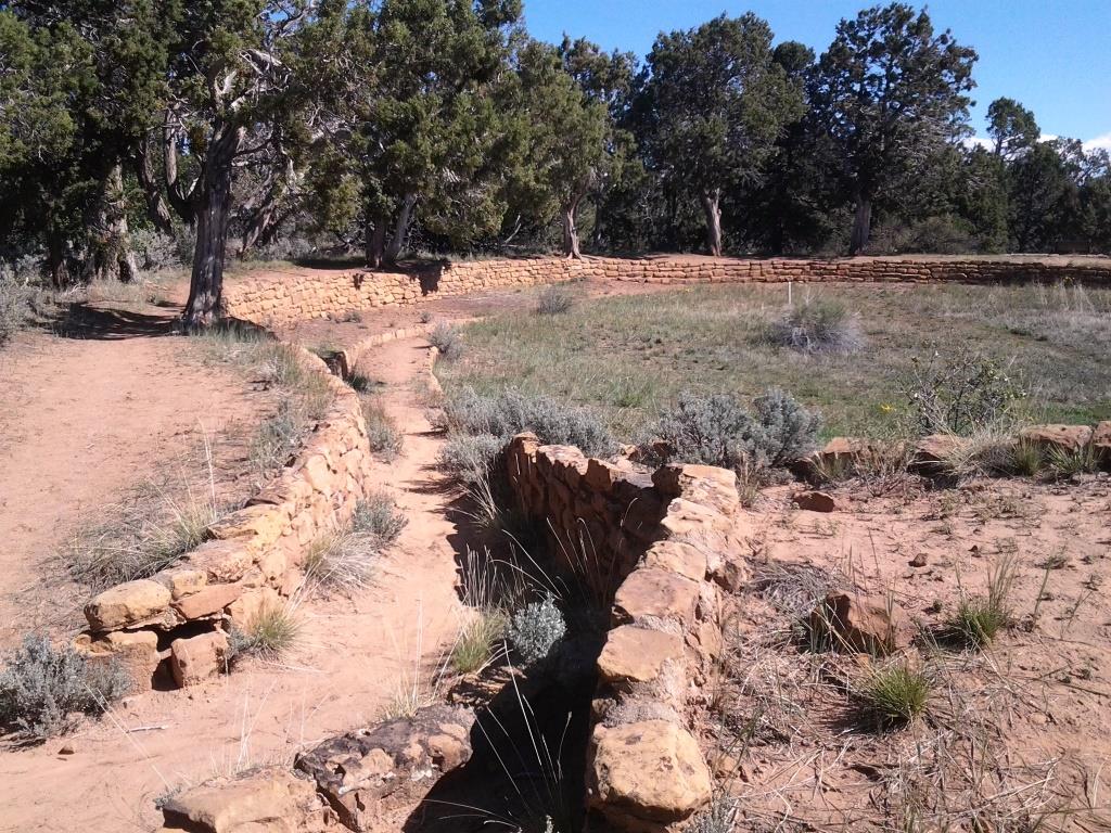
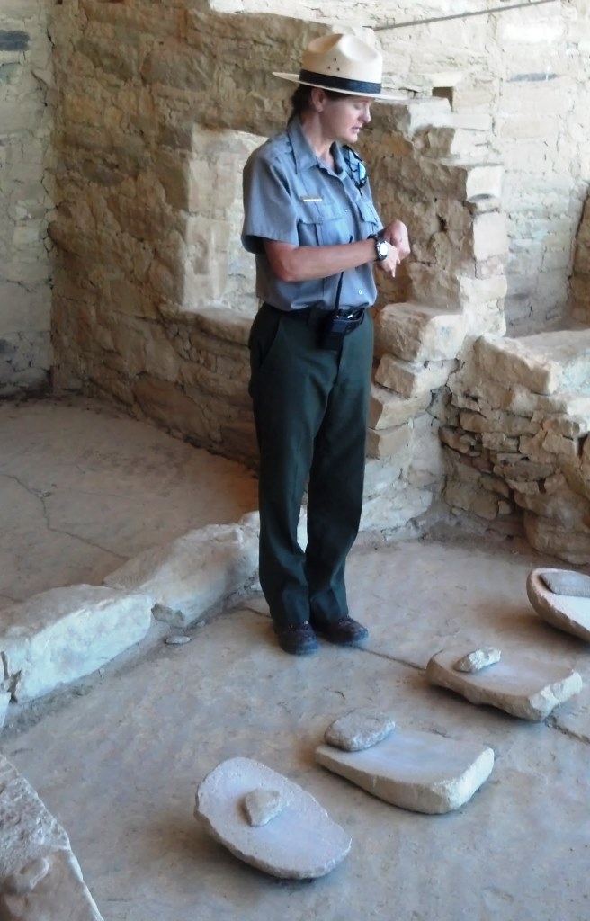
Spruce Tree House is the only cliff dwelling on the Chapin Mesa you can visit without having to sign up for a tour. A 1/4 mile paved path leads from the museum to the site and a park ranger is always at the site to answer questions and ensure no one messes with the buildings or artifacts.
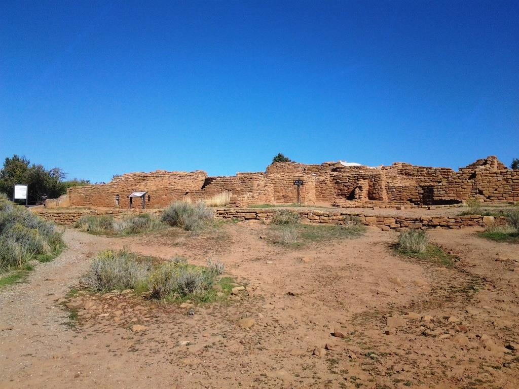
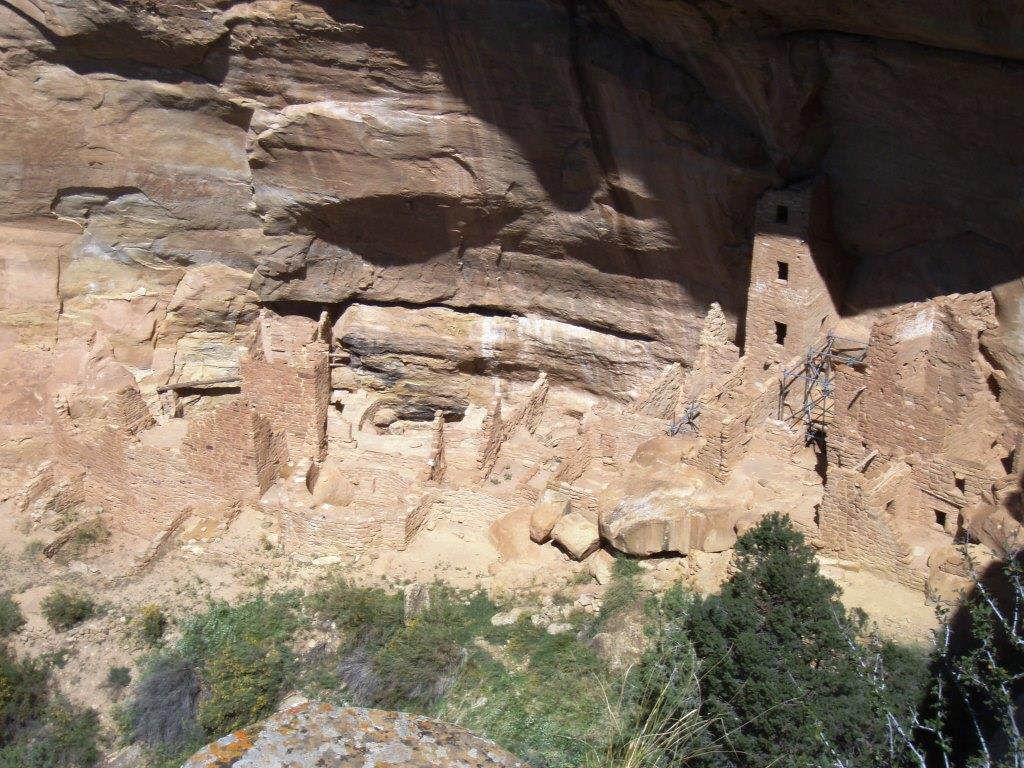
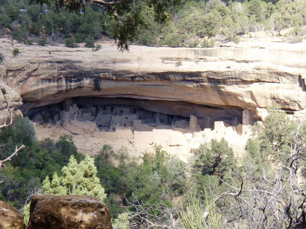
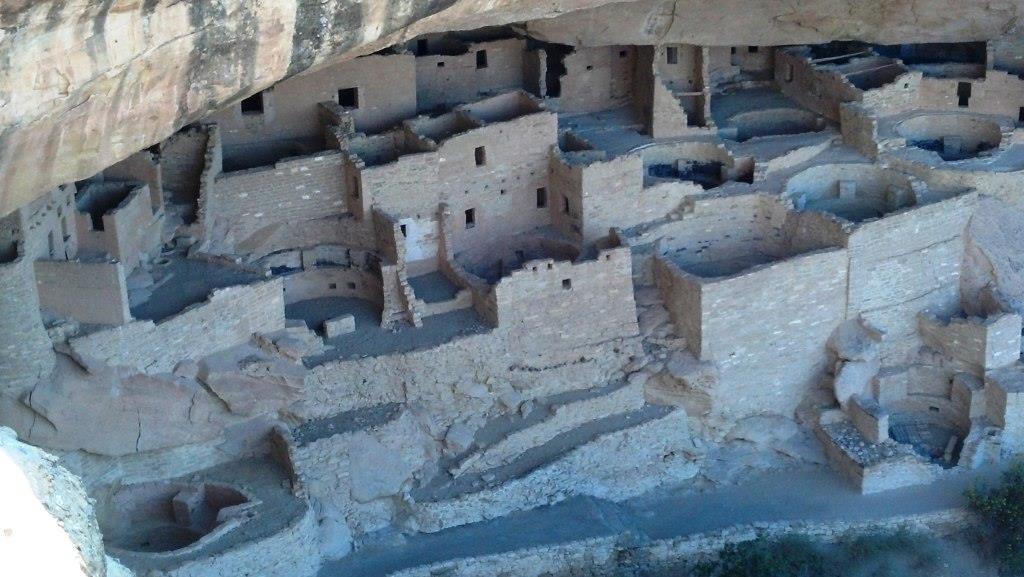
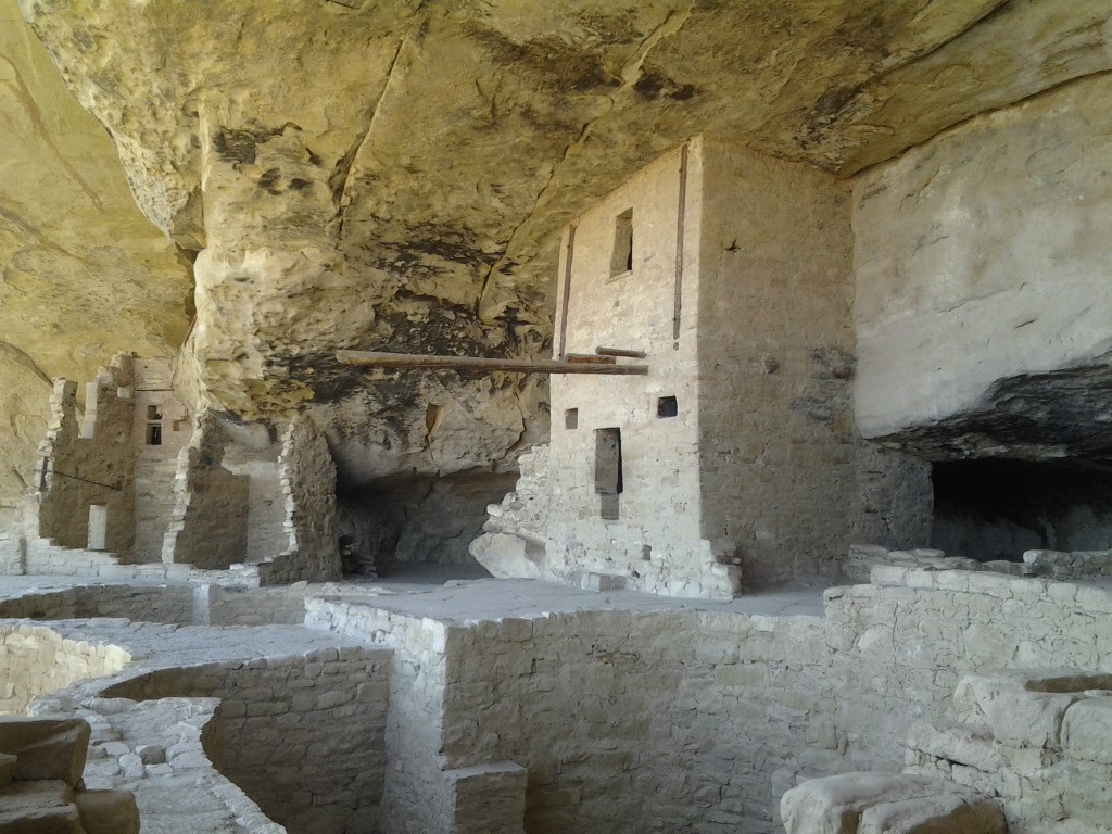
On the way down you get a terrific view of the entire house.

Spruce Tree House
The term “house” is a misnomer as the house is really a community. The house consists of room blocks, ledge rooms (for food storage), courtyards, and kivas. The house contains quite a few two and three story structures. Pretty amazing considering that the sandstone blocks are only held together with a clay mortar.
Many of the door openings are T-shaped. One theory has it that these openings allowed people to enter while carrying wide loads.

T-shaped openings in second floor structure at Spruce Tree House
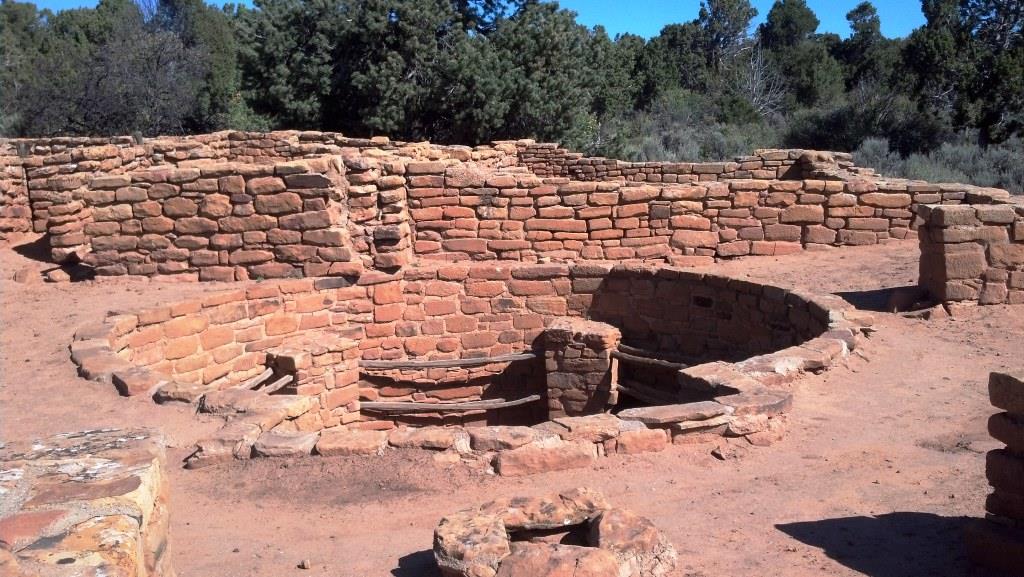
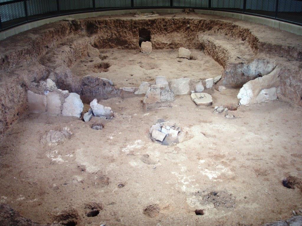
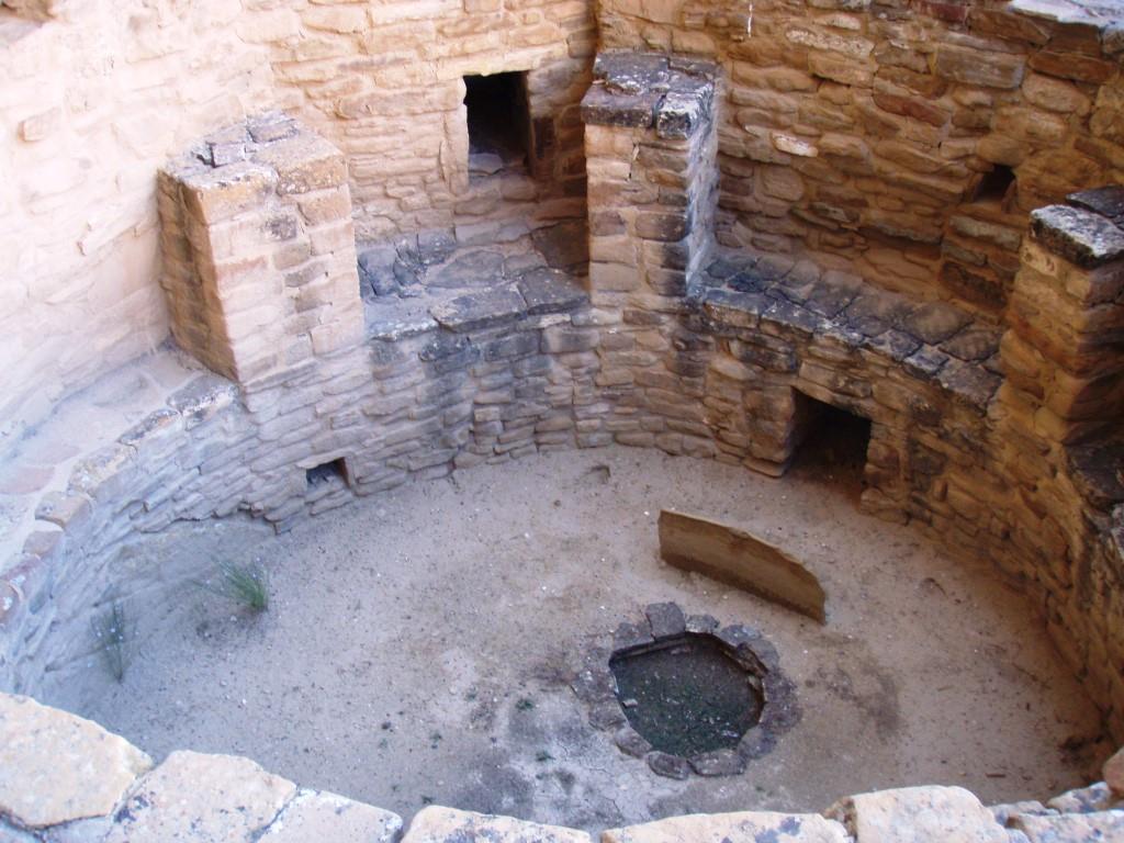
Kivas are circular rooms dug into the ground. There’s an air shaft for ventilation and a short air deflector wall between the air shaft and the firepit. In line with the air shaft and firepit is a small hole called a sipapu that allows spirits to move between the past and the present. If you stand at the air shaft and face the sipapu, you are facing south.
A bench with six pilasters surrounds the kiva.The pilasters end about three to four feet below the top of the kiva. The roof structure starts at the top of the pilasters and ends at ground level. This makes a kiva well-insulated and a place where the inhabitants spent most of their time in the cold winter months. The roof of the kiva was used as a courtyard.

Kiva at Spruce Tree House
Spruce Tree House has a replica of a kiva you can climb into. At first look, you see a large courtyard with a square hole with a ladder sticking up out of it. You do not realize you are standing on the roof of another room. Climb down the ladder and you’re in. It is cool and quiet. A square of light shines down from above. You realize you are in a deep hole with 3-4 feet of earth over your head and people are walking there without knowing that you are down below. This is where you might shelter with your family in the winter or go to cool off in the heat of the summer. You may be weaving or grinding corn here. The fire in the hearth would warm you. Your entire family may be sheltered here. Other times or other kivas may be for ceremonial use.
This is not a kiva roof that stood the test of time. The park service rebuilt this so people could experience what it was like to be in a kiva. Tests show that the inside temperature of the kiva was around 50 degrees no matter what the outside temperature was.
While exploring Spruce Tree house, take note of the beautiful stone work and remember that these stones were shaped without modern tools. There are marks showing blocks chipped out using another, harder stone, perhaps a river stone. The guide book includes a picture taken long ago. Compare the picture to the current view and note how much of this dwelling is the original structure that has stood the test of time.
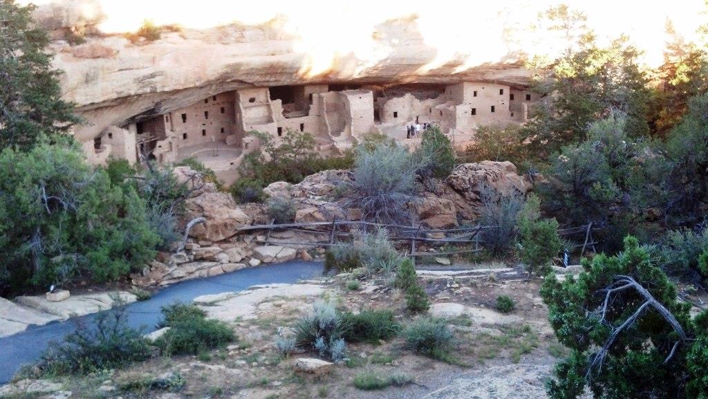
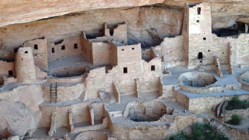
Cliff Palace
Compared to Spruce Tree House, Cliff Palace is huge. It’s the largest cliff dwelling in North America. The really amazing thing is that it only took 20 years to build, from 1260AD-1280AD. Even more amazing is that the Ancestral Puebloans abandoned Mesa Verde a mere 20 years after Cliff Palace was finished.

Cliff Palace
Most of the sandstone blocks were hand shaped. The mortar was a mix of sand, clay and ash. But like people today, there were some builders who weren’t as meticulous as others. A few sections of the walls were haphazardly built, whether on purpose or as an emergency patch isn’t known.

Left side of Cliff Palace
Cliff Palace contains about 150 rooms, 75 open spaces or courtyards, and 21 kivas.
Living rooms, indicated by the presence of a hearth, were rectangular and measured about 8′ by 6′. Cliff Palace contains only about 25 living rooms, which leads archaeologists to estimate that 100 to 120 people lived here.
Food storage rooms were built into shall shallow alcoves near Cliff Palace. They were well protected from the elements and from birds and animals.

Storage rooms built in shallow alcove above Cliff Palace
Open areas included kiva rooftops, courtyards, and plazas.
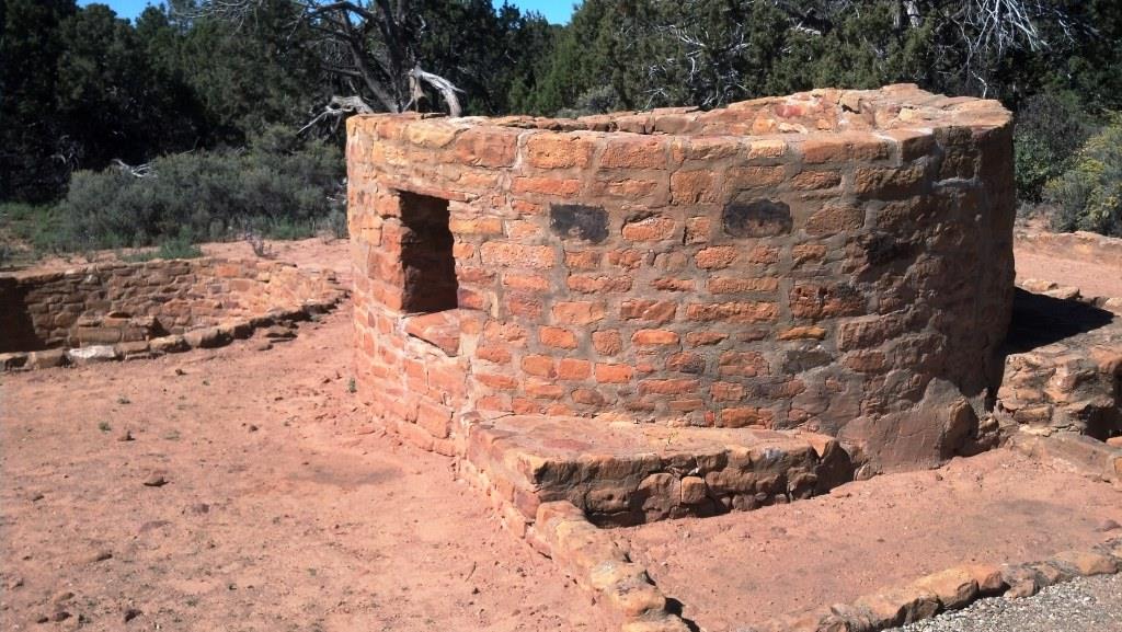
The round tower shown was probably surrounded by living rooms. There were no interior ladders (except for kivas), so exterior ladders were used to access upper stories and roofs

Round tower
The next image shows more details of the right side of Cliff Palace.

Right side of Cliff Palace
The circular holes are kivas. You can clearly see the pilasters that would have supported the kiva roof.
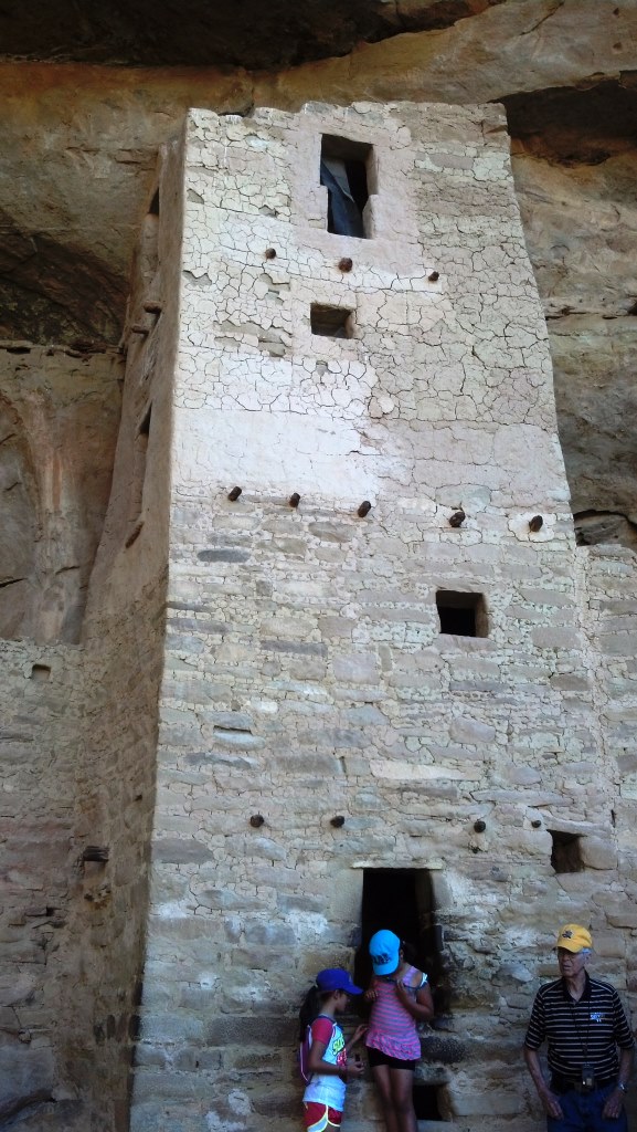
The largest structure in Cliff Palace is the square tower.

Square Tower
It rises four stories above the ground.
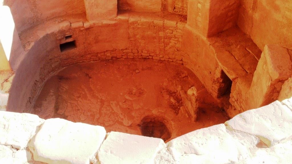
The following image shows a closeup of a kiva.

Kiva at Cliff Palace
The hole in the center of the kiva is a firepit. The short rectangular wall is an air deflector. Outside the kiva, the air shaft is dug vertically until it is level with the kiva floor. The air shaft makes a right angle and comes out at the square hole just behind the deflector wall. The height of the roof can be measured from the top of the pilasters (three are visible in the image) to ground level above – roughly three to four feet. There’s a square hole in the roof directly over the fire pit. A wooden ladder is used to get into and out of the kiva.
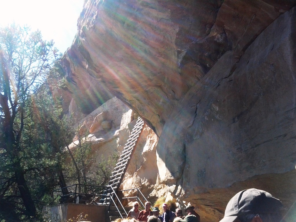
To get into and out of the Cliff Palace, the Ancient Puebloans used hand and toe holds that were chipped into the cliff face. To bring modern Americans in and out the Park Service had to make it a little easier. The tour takes you down stone stairs carved and built into the rock wall by the Civilian Conservation Corps, then across a ledge to Cliff Palace. Getting out takes a bit more work. First you follow the ledge to the right, climb a few more of those nice stone stairs, step into a narrow cleft in the rock then start climbing.

Cliff Palace exit – stone steps, three 10 foot ladders in cleft in cliff – far right
There are three 10-foot ladders to climb. Since you are in the cleft, there is no view of the drop off below so you only have to contend with the tight climb. As you climb, if you look to the right, you can see the toe and hand holds going up the sheer cliff face beside you where the original cliff dwellers climbed. Once done with the ladders, there are more steps and a trail on the top of the cliff to follow back to your car.
Balcony House
Compared to Cliff Palace, Balcony House was a bit of a letdown. It was still fascinating, but was much smaller than Cliff Palace and in a much higher state of disrepair. If you only have time for one tour, do Cliff Palace.

Balcony House small balcony
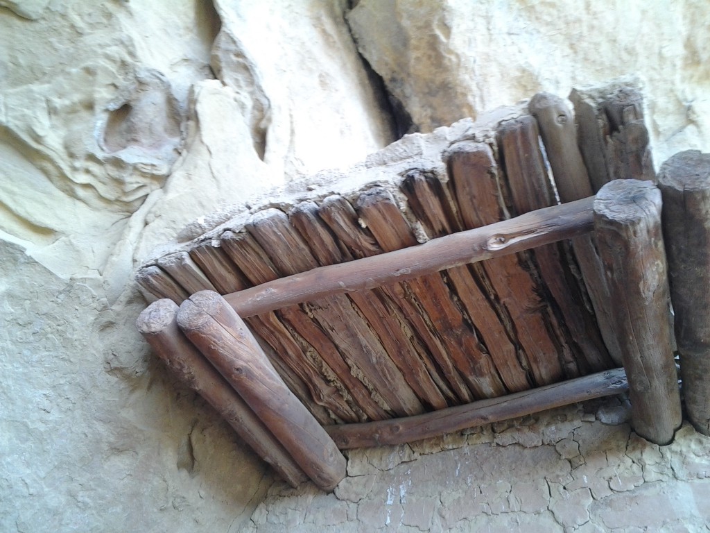
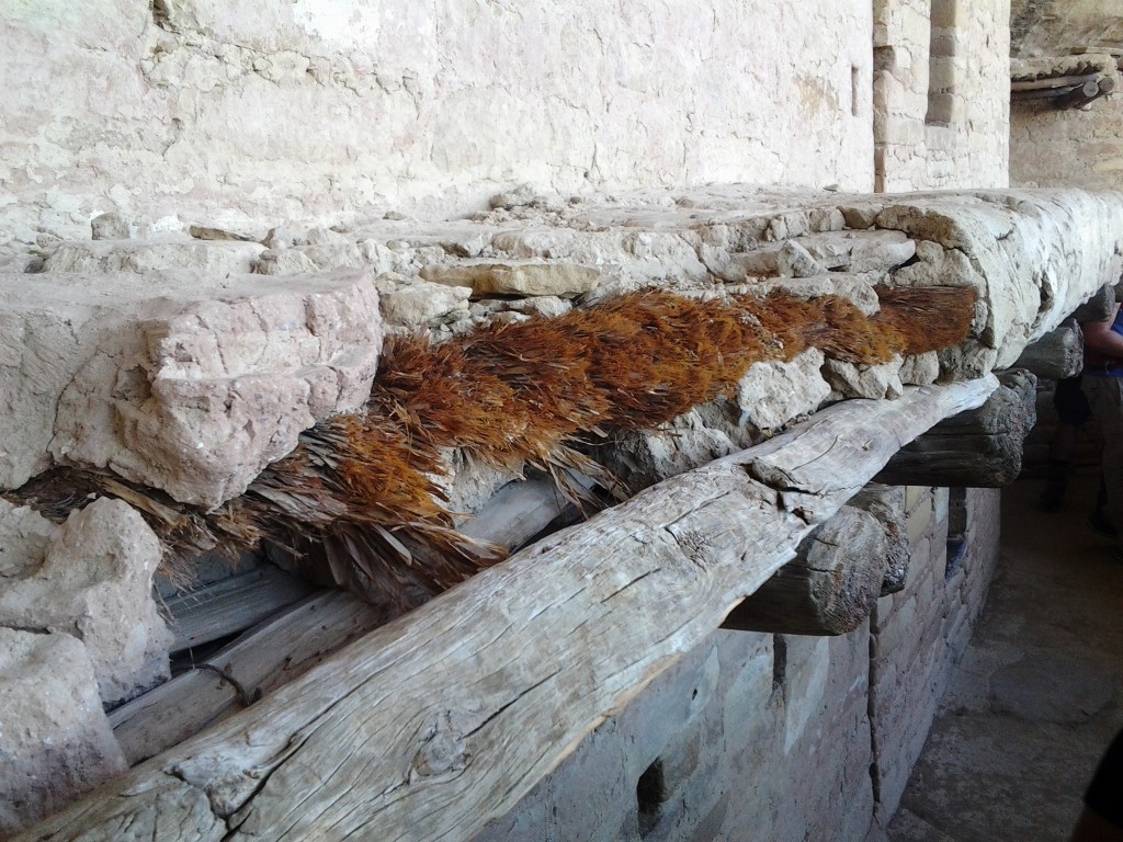
Balcony house was named for the second floor balconies that still exist on several of the buildings. They are the original wood supports with the original fiber filling and clay topping. That would be more than 700 year old wood, fiber and clay. The balconies were used as walkways to access the upper floors of buildings. Some second story buildings would have a single story building beside it so the roof of the lower building became the courtyard of the taller building. For those with no lower levels to walk on, the balconies became the sidewalks.

Original Fiber and clay in balcony
Our tour guide gave us some great insights into what life, and death, was like for the Ancestral Puebloans.
They used dry farming techniques to grow corn, beans, and squash in fields on the mesa top. All three crops were grown together – beans were planted so they would coil up the cornstalks, while squash was planted between the corn, which helped shade the roots of all the plants and retain moisture.

Balcony House main courtyard
After harvesting the corn, it was ground using a mano (small stone) and a matate (sandstone slab). Because sandstone is relatively soft, the grinding process mixed sand in with the ground corn. The corn was used to make a gruel. Over time, the sand in the gruel ground down a person’s teeth, exposing the roots. These got inflamed and infected and caused a great deal of pain. The infection could spread throughout the body and result in death. Ouch.

Mano and matate
Infant mortality was high among the Ancestral Puebloans. Archaeologists who examined the remains of children between 0 and 5 noticed many had broken bones. They also noticed fewer broken bones among those who survived their early childhood. Living in a cliff dwelling was very hazardous to young Ancestral Puebloans. Even those who survived past their childhood often died in their 30s.
The Balcony House tour shows that the National Park Service has a sense of humor. To get in you go down stone steps, across a ledge and then up a double-wide, THIRTY FOOT tall ladder.

Balcony House tour entrance – 30 foot ladder
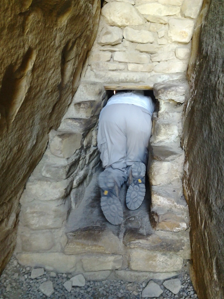
There is no evidence a ladder was here 1100 years ago and thirty feet is far longer than any timber in the area would grow so this seems to be purely a Park Service addition. The ladder is placed on a little concrete platform that is at least 15 feet wide but if you look down while climbing, your eyes are drawn past that little platform and down, down, down into the canyon floor below. While the ladder must be a challenge to many, it still beats those little chipped out hand and foot holds that the Ancient Puebloans used. Once up the ladder you are in the first courtyard where you can admire the balconies that gave the house its name. But you aren’t done climbing. There were hand and foot holds chiseled into a boulder and the only way to the rest of the house is up and over. Thankfully the park service chiseled them a little wider and deeper to accommodate our footwear. Once over the boulder you crawl through a tight little crevice and up a little ladder to the main courtyard. Phew! You’re in…
Getting out is even more fun.

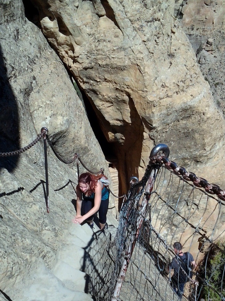
Squeezing into Balcony House
First you crawl through a tunnel which is believed to be the only entrance/exit way back when, then up a ten foot ladder and across a little ledge (chain handrails are imbedded in the rock to keep you from sliding off the cliff – thank you Park Service!),

Balcony House Exit – stage 3 – hand and toe holds and steps
then up some more of those enlarged hand and foot holds, then up some carved steps, across another ledge, up another 10 foot ladder, and you’re done! Piece of cake.
Note: if you are worried about fitting through that tunnel, there is a “sample” tunnel in the visitor center near Rte 160 before you go through the actual park entrance station. You can go in by where they sell tickets and check it out.
J&H